FROM GARFIELD COUNTY EMERGENCY MANAGEMENT
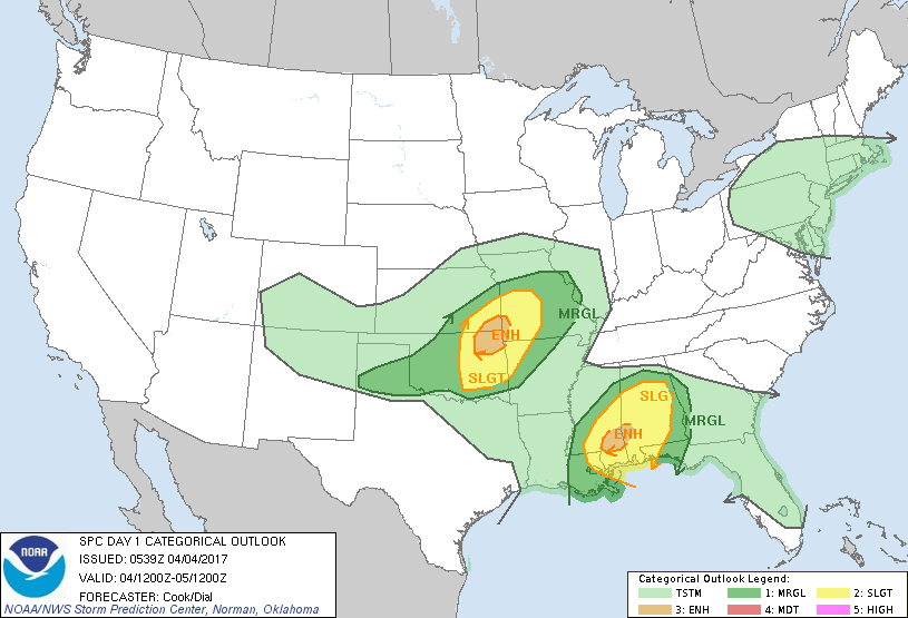
We are in a MARGINAL risk for severe weather later today here in Garfield County. The highest risk is in the NE quadrant of the state which includes the Tulsa area. They are in an ENHANCED RISK AREA. If you plan on traveling that way today, stay EXTREMELY WEATHER AWARE.
For our area, if storms occur later this afternoon we can expect hail and wind as our main threats along with heavy rainfall. The tornado threat here is low.
That said, here is your forecast from the NWS/NORMAN
Tuesday-Showers and thunderstorms, mainly before 7am, then showers likely and possibly a thunderstorm after 1pm. High near 60. Northeast wind 13 to 18 mph, with gusts as high as 25 mph. Chance of precipitation is 80%. New rainfall amounts between a tenth and quarter of an inch, except higher amounts possible in thunderstorms.
Tuesday Night-Showers likely, mainly before 1am. Cloudy, with a low around 42. North northwest wind 16 to 24 mph, with gusts as high as 33 mph. Chance of precipitation is 60%. New precipitation amounts between a quarter and half of an inch possible.
HAVE A SUPER DAY!!
MIKE