TUESDAY UPDATE FROM ENID/GARFIELD COUNTY EMERGENCY MANAGEMENT-8/14/18
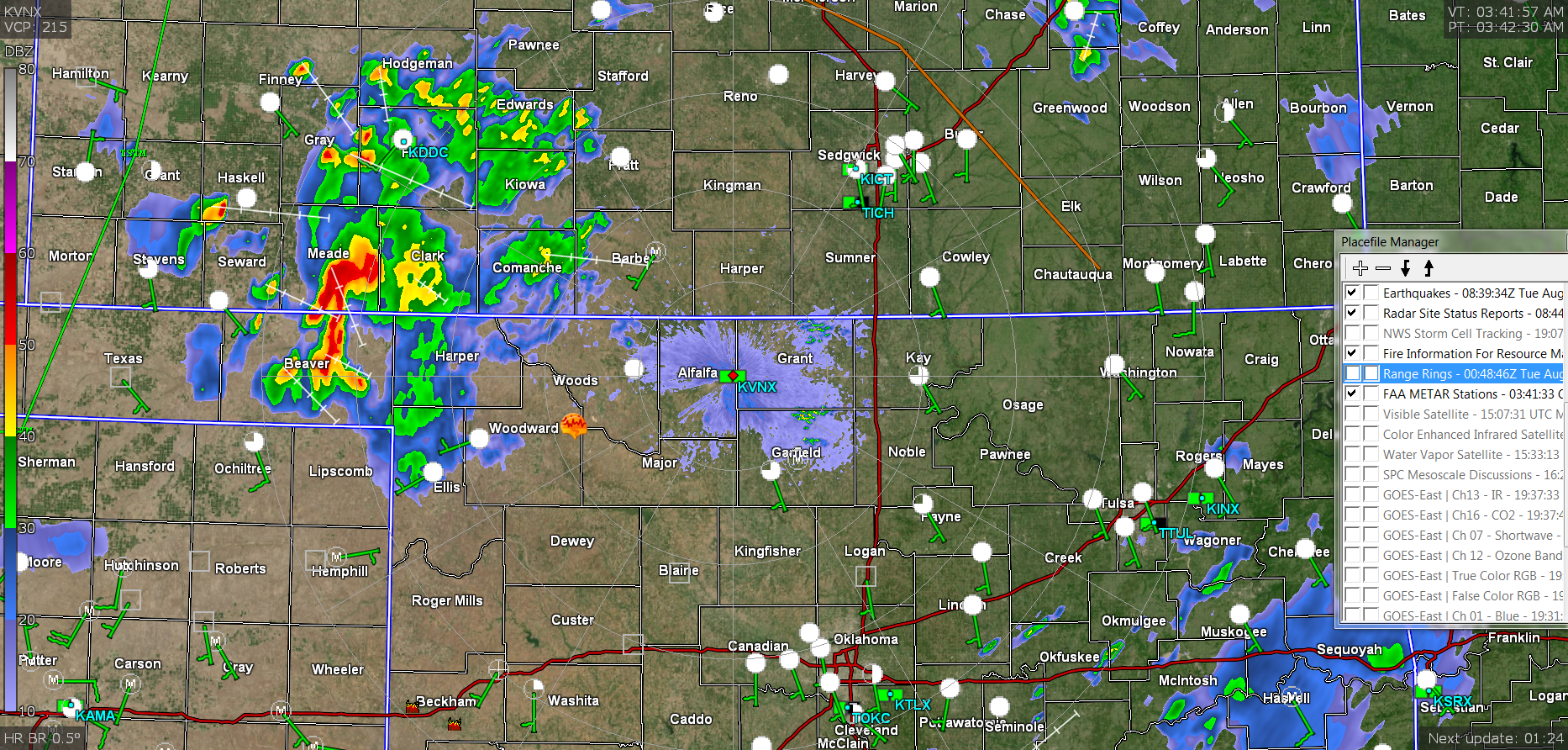
THE RADAR PIC IS FROM 0341 LOCAL TIME.
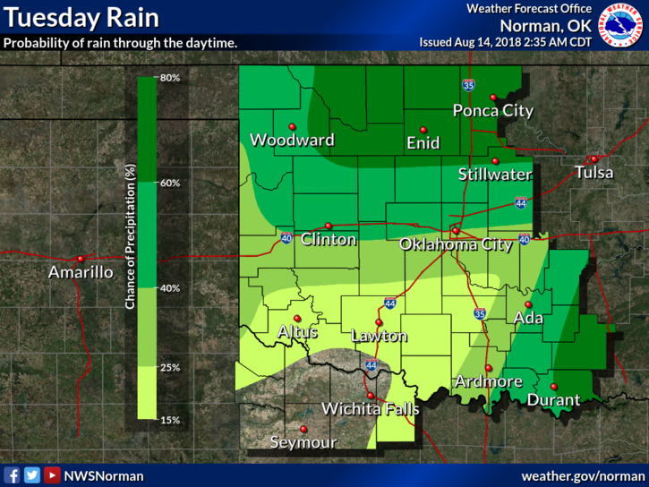
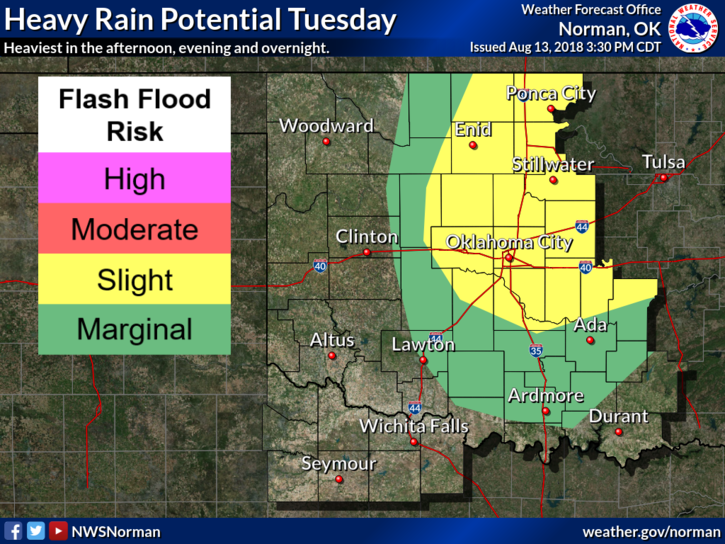
1-Showers and thunderstorms will continue today as the upper low moves off to the northeast. As I type this morning at 0330L, storms are centered in far northwest Oklahoma and southern Kansas moving slowly ESE. This will give us another threat for heavy rainfall. 24hr totals vary across the county from .42 at the Lahoma Mesonet site to 2.5 inches at the Breckenridge Mesonet site. Totals will vary where heavier rainfall fell.
2-Today, there may be heavier convection(storms) around the area as they move across the region. Many questions remain on what may happen, where things may occur, but the main issue will be heavy rainfall and where localized flooding might occur. Just pay attention to the area you are in and understand that localized flooding might occur.
3-What about severe weather? If there are any breaks in the clouds today, there may be greater instability thus the possibility of stronger storms. The potential for stronger storms today is higher than the last few days so stay aware. IF there is severe weather, strong winds, torrential rainfall, and lightning are the main threats. The tornado threat is VERY LOW but never completely out of the question. We’ll be ok.
4-Here is your forecast from the NWS/NORMAN;
Today-Mostly cloudy. Patchy fog early in the morning. A chance of showers and a slight chance of thunderstorms in the morning, then thunderstorms likely in the afternoon. Highs in the mid-80s. South winds around 10 mph. Chance of precipitation 60 percent.
Tonight-Mostly cloudy. Thunderstorms likely in the evening, then a chance of thunderstorms after midnight. Lows in the mid-60s. South winds around 10 mph in the evening becoming light and variable. Chance of thunderstorms 70 percent.
FINALLY, I am monitoring all of this mess from Norman at the Emergency Management Conference. You all HAVE A GREAT DAY!!
MIKE