0400L-TUESDAY OUTLOOK & UPDATE FROM GARFIELD COUNTY EMERGENCY MANAGEMENT-8/20/19
GARFIELD COUNTY EM is our notification app. Being prepared in this county begins with this app. If you don’t have it, YOU are NOT PREPARED!
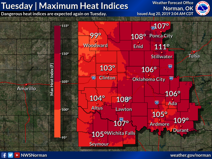
1- EXCESSIVE HEAT WARNING IN EFFECT FROM NOON UNTIL 9PM TONIGHT. Stay hydrated and be careful out there.
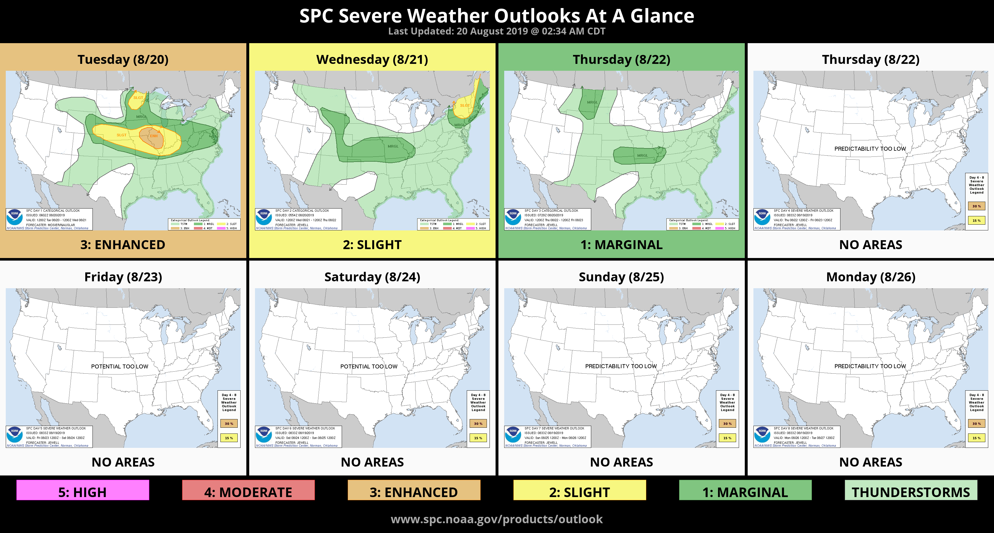
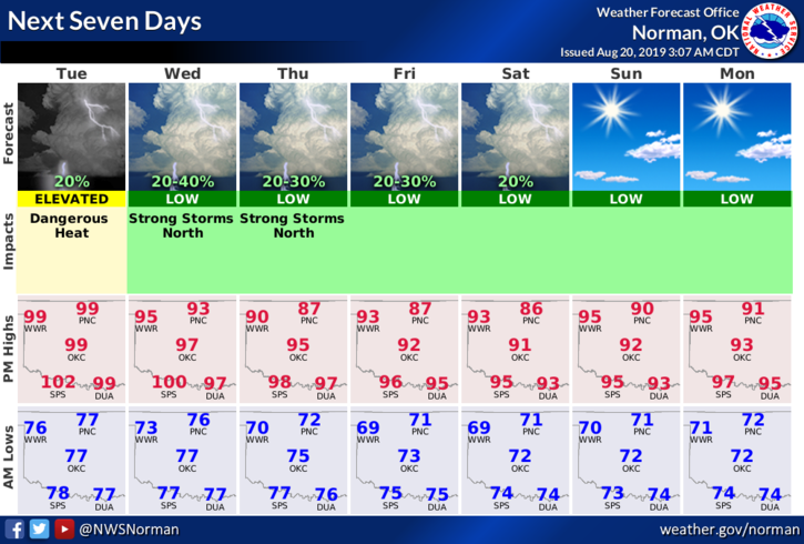
2- GENERAL RISK for thunderstorms later this evening. Even though chances are low, if storms occur, a few could be severe due to winds and hail. We’ll see what occurs. On Wednesday and Thursday, we’ll have a better chance for severe weather as a cold front gets involved.
3- Keeping this short and sweet, here is your forecast from the NWS/NORMAN;
Today- Mostly sunny with highs around 102. South winds 10 to 15 mph.
Tonight- 20% chance for thunderstorms with lows in the mid-70s. South winds 10 to 15 mph.
HAVE A GOOD DAY AND STAY COOL!!
MIKE