FROM GARFIELD COUNTY EMERGENCY MANAGEMENT-TUESDAY 8/22/17
DOWNLOAD OUR EMERGENCY APP-“GARFIELD COUNTY EM” IT JUST MIGHT SAVE YOUR LIFE!! https://gcem.org/garfield-county-em/
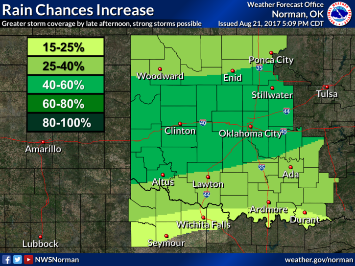
The eclipse is over now so we move on to up and coming weather events. Nothing major as it looks but we will have a cold front move through late this morning or early afternoon. Per NWS Guidance, storms look to fire along the I-40 corridor. If that’s the case, we may just see a wind shift as the front pushes through or we may see some shower activity as passage occurs. We’ll see what happens.
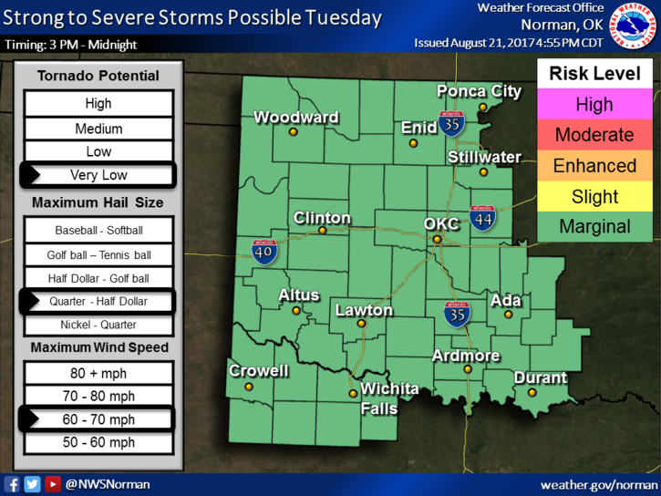
That said, we are in a MARGINAL RISK for severe weather. See the graph attached. Hopefully we’ll see some precip today. We’ll keep an eye on the front as it progresses. Here is your forecast from the NWS/NORMAN;
Tuesday-40 percent chance of showers and thunderstorms, mainly after 1pm. Partly sunny, with a high near 90. Southwest wind 7 to 13 mph becoming northeast in the afternoon.
Tuesday Night-20 percent chance of showers and thunderstorms before 1am. Partly cloudy, with a low around 64. Northeast wind 7 to 11 mph.
Have a super day!!
MIKE