0310L-TUESDAY OUTLOOK FROM GARFIELD COUNTY EMERGENCY MANAGEMENT-12/01/2020
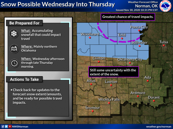
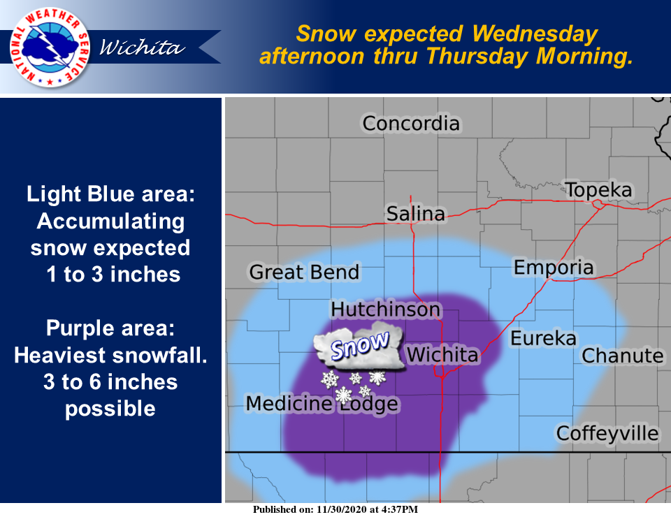
1-NOW is a good time to download our GARFIELD COUNTY EM app. WINTER STORM WATCH is now in effect beginning WEDNESDAY AT NOON until THURSDAY AT NOON. 3 to 5 inches of snow is a possibility and driving conditions may be a bit touchy during this time. Keep in mind that graphics are estimates of areas and these will change as the forecast verifies. I have added a graphic from the Wichita NWS Office along with 2 from Ours in Norman.
2- NO NEED TO PANIC as we should see some rain activity and then a quick changeover to snow per guidance. Where the heavier snow does fall hasn’t been set in stone yet as the storm track ISN’T EXACT right now. It does look like that southern Kansas may get the brunt of the snow. We’ll see what happens and adjust from there.
3- OVERALL, WE’LL BE OK. We’ll have updated information during the day. If there’s a major change in the forecast, I’ll send that information over our GARFIELD COUNTY EM app.
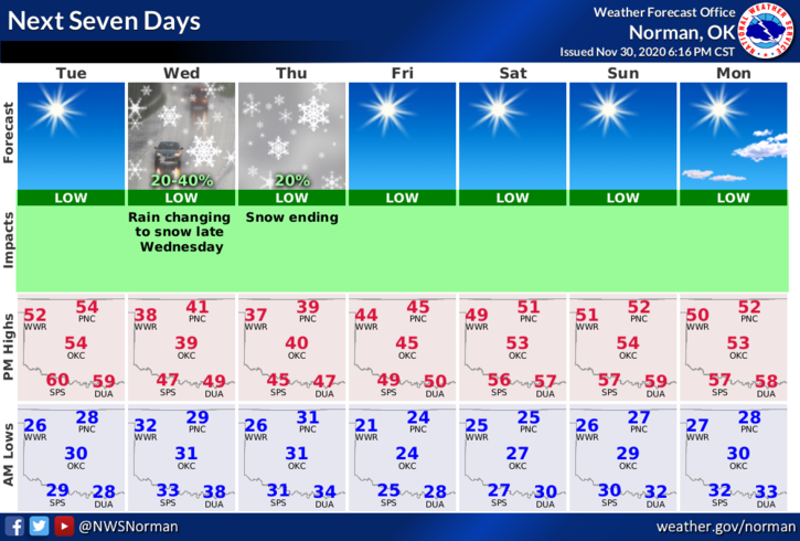
4- Here is your forecast for today from the NWS/NORMAN;
Tuesday- Sunny. Highs in the mid-50s. South winds around 10 mph.
Tuesday Night- Mostly clear. Lows in the upper 20s. Light and variable winds becoming north 10 to 15 mph with higher gusts after midnight.
HAVE A GOOD DAY!!
MIKE