0350L-WEDNESDAY OUTLOOK FROM GARFIELD COUNTY EMERGENCY MANAGEMENT-12/2/2020
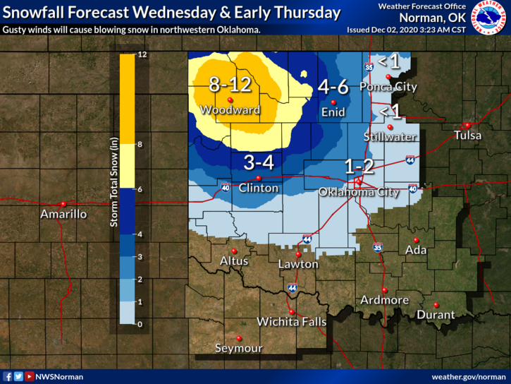
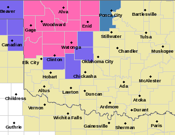
1-WINTER STORM WARNING IN EFFECT FROM NOON TODAY UNTIL NOON THURSDAY. This storm system is moving slower than expected so snow amounts have increased. We could receive upwards of 3-6 inches of snowfall and then again maybe more or less. We’ll wait and see how this mess comes together.
2- Use extreme caution while driving and watch out for elevated surfaces like overpasses and then bridges that may freeze over due to snow and of course colder temps. WHITEOUT conditions will play a role as winds are forecast to be in the 25 mph zone. Just be careful while out and about.
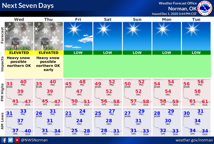
3- WE WILL SURVIVE AND WE’LL BE OK so no need to panic out there. Here is your forecast from the NWS/NORMAN;
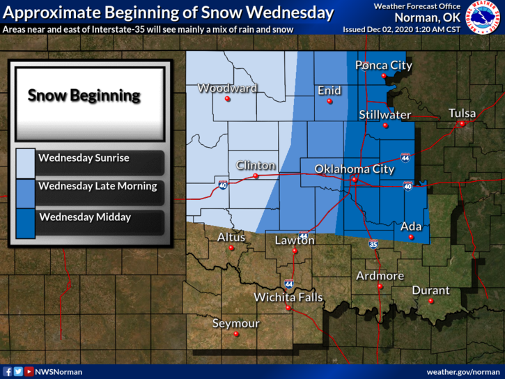
Today- Rain and snow likely in the morning, then rain and snow in the afternoon. Colder. Highs in the mid-30s. North winds 10 to 15 mph. Chance of precipitation 80 percent.
Tonight-Cloudy. Snow and rain likely in the evening, then a chance of snow after midnight. Lows in the upper 20s. North winds 10 to 15 mph. Chance of precipitation 70 percent.
If you would, send snow pics to me through the GARFIELD COUNTY EM app under ASK THE DIRECTOR or DAMAGE REPORTS. If you don’t have the app, get it and/or then email your pics to me. It is appreciated.
HAVE A GOOD DAY AND STAY WARM.
MIKE