0350L-TUESDAY OUTLOOK & INFO FROM GARFIELD COUNTY EMERGENCY MANAGEMENT-12/17/19
1- Here is some preparedness info for those expert drivers. Only you know who you are; weather systems as yesterday’s can leave you with a few dents in your vehicle or a really mashed up vehicle. Freezing MIST can be seen on your windshield, you can feel its effects on your car but you really can’t see it on the ground. This is where folks get in trouble by driving too fast on what seems like good roads. When we state slow down and use extreme caution, this is why. Another reason is when you get out of your vehicle, walking carefully is also a good idea. You really don’t want to break anything falling on that thin layer of ice. Just be careful next time.
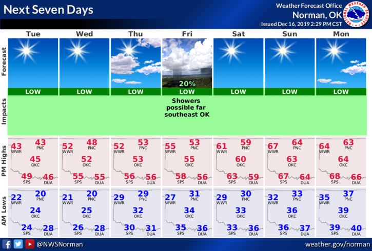
2- We will be chilly today but we’ll eventually warm back up. FOG is a strong possibility in some areas so if it occurs before we get above freezing, well slow down and use extreme caution while driving and walking.
3- Overall, the rest of the week looks good with that gradual warmup so be careful and we’ll see how the forecast pans out for Christmas.
4- Here is your forecast from the NWS/NORMAN;
Tuesday- Sunny with a high near 44. West-northwest wind 5 to 15 mph.
Tuesday Night-Clear with a low around 21. West-southwest winds 5 to 10 mph.
HAVE A SUPER DAY!!
MIKE