0305L-TUESDAY OUTLOOK FROM GARFIELD COUNTY EMERGENCY MANAGEMENT-12/21/21
GARFIELD COUNTY EM IS OUR EMERGENCY NOTIFICATION APP. IF YOU DON’T HAVE IT, YOU WILL NEED IT. DOWNLOAD IT TODAY!
1- Cool air, low humidity & dew point temps, and mostly clear skies will bring nice conditions if you are standing in the sun out of the breeze. Otherwise, you may be a bit chilly out there. This is what we can expect until the latter part of the week as winds begin to increase.
2- We will warm up a little more and the winds will increase towards mid to late week so just keep your eyes peeled for smoke and fire. Call 911 and do the best you can in giving a good location so a proper response can be sent.
3-The most dangerous hazard out there right now are those folks who feel driving very erratic is the right thing to do. Most I have seen are texting and not even looking up. Crossing the center line, running lights or stop signs, etc. will get you and possibly others hurt or killed. What is happening on your phone that makes it more important than paying attention while driving? Just remember, your phone becomes evidence if you have an accident.
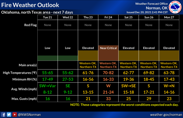
4-Here is your forecast from the NWS/NORMAN;
Tuesday-Sunny. Highs around 60. Southwest winds around 10 mph.
Tuesday Night-Clear. Lows in the lower 20s. Light and variable winds.
Stay safe.