0400L-TUESDAY OUTLOOK FROM GARFIELD COUNTY EMERGENCY MANAGEMENT-12/29/20
GARFIELD COUNTY EM is our informative app. If you don’t have it, you will need it, so download it today.
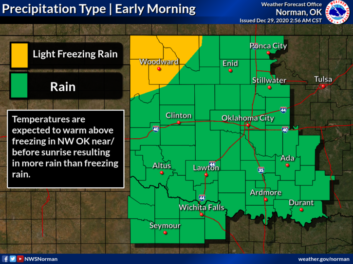
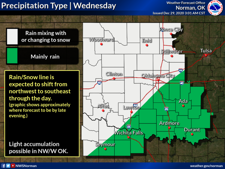
1- Winter Weather Advisory out in far NW Oklahoma will expire at 0900L this morning. Temps will rise up into the 40 to 50 range area wide during the day. Tonight, we may see some rain changing over to snow if the atmosphere cools sufficiently. Best chance to see snow would be early morning Wednesday through the afternoon hours. We’ll see what happens.
2- Overall, we’ll be ok BUT if we do receive ANY frozen precip, it might be a bit slippery on elevated surfaces so drive with caution.
3- The Vance WSR-88D weather radar was turned back on by the NWS this week so they would have a better handle on the weather up here. After the rain moves out, you will continue to notice what appears like rain. It’s not. Ground Clutter Suppression is inoperable and replacement parts are on the way. It takes time to get them especially over the holiday season. Don’t worry, we can read the difference in imagery so we’ll be ok.
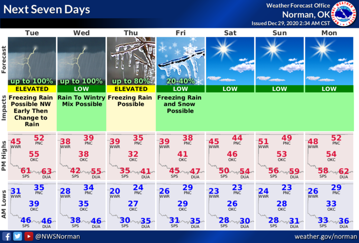
4- Here is your forecast from the NWS/NORMAN;
Today- 80% chance for rain today with chances off and on all day. Thunderstorms are also possible after 3pm. High near 54. South southeast winds 10 to 20 mph gusting to 29 mph.
Tonight- Rain before 3am then a chance of rain and snow. Some thunder is also possible. Low around 33. South winds 10 to 20 mph becoming north after midnight. Winds could gust as high as 25 mph. Chance of precipitation is 90%. Little or no snow accumulation expected.
HAVE A GOOD DAY!
MIKE