0345L-WEDNESDAY OUTLOOK FROM GARFIELD COUNTY EMERGENCY MANAGEMENT-12/30/20
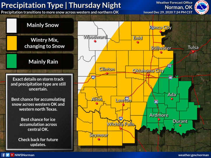
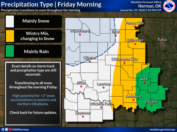
1-WE ARE IN A WINTER STORM WATCH FROM” THURSDAY” AT NOON THROUGH FRIDAY MORNING. 2 TO 4 INCHES OF SNOW AND POSSIBLY UP TO ¼ INCH OF ICE. DRIVING CONDITIONS ARE EXPECTED TO DETERIORATE LATE THURSDAY NIGHT INTO FRIDAY MORNING.
2-Now is a good time to download our GARFIELD COUNTY EM app. If you want to have access to great weather and disaster information along with receiving information directly from us and the NWS, GET IT TODAY!
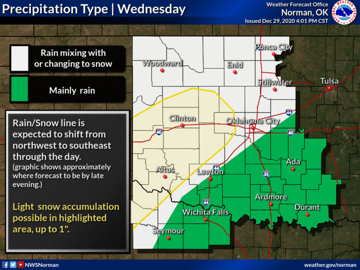
3- Looking at the forecast for today and tomorrow, there may be periods of light snow and then some rain. Thursday evening, as this system moves across the area, could get interesting as the atmosphere continues to cool, temps aloft will be warmer than the surface thus the ice storm possibility. When the atmosphere completely cools to below freezing, we should see all snow. TIMING OF ALL THIS MESS IS THE MAIN ISSUE SO SIT BACK AND HOPE FOR COLDER TEMPS. We’ll see what happens and how this forecast modifies over time.
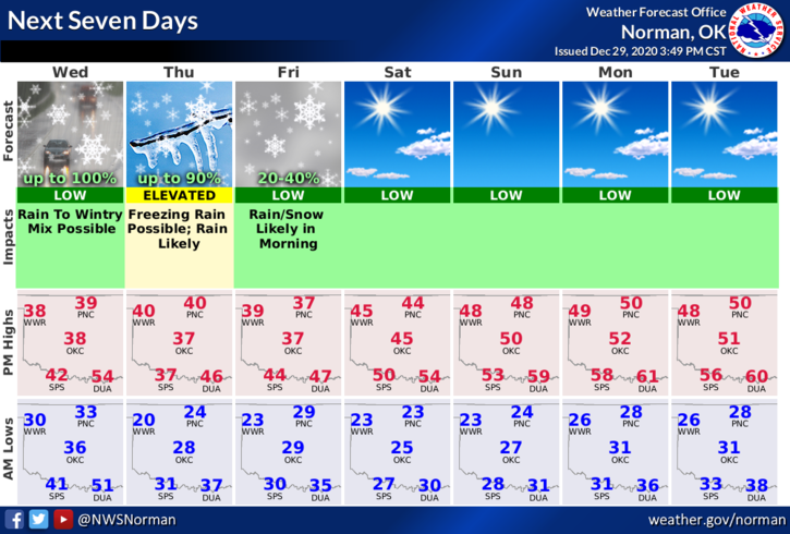
4- Here is your forecast from the NWS/NORMAN;
Today-Decreasing clouds. A chance of rain and snow early in the morning, then a chance of snow and a slight chance of rain late in the morning. Colder. Highs in the lower 40s. North winds 10 to 15 mph. Chance of precipitation 50 percent.
Tonight-Partly cloudy. Colder. Lows in the lower 20s. North winds around 10 mph in the evening becoming light and variable.
THE GRAPHS ATTACHED WERE NOT UPDATED BY THE NWS BY THE TIME I SENT OUT MY POST. I WILL UPDATE THEM LATER.
I’LL ADVISE AS NEEDED.
MIKE