0340L-MONDAY OUTLOOK FROM GARFIELD COUNTY EMERGENCY MANAGEMENT-12/28/20
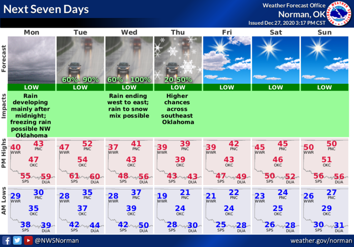
1-This is going to be an interesting week. We should see some rain, freezing rain, & snow at different times through Thursday. The winter precip should occur during the overnight hours so if it does occur, slow down on your way to work. The forecast will change many times this week so if you see graphics posted by myself or the NWS, they will change several times too. I will try to keep up with those changes but you can also go to the NWS/NORMAN homepage here- www.weather.gov/oun/
2- Overall, we’ll be ok so just be prepared for some slippery conditions during the overnight hours this week. Here is your forecast from the NWS/NORMAN;
Monday- Mostly cloudy. Colder. Highs in the mid-40s. Northeast winds around 10 mph.
Monday Night- Mostly cloudy. A chance of rain after midnight. Lows in the lower 30s. East winds 10 to 15 mph. Chance of rain 50 percent.
Finally, you have probably noticed that I only post on facebook in the early mornings now. I no longer have facebook or twitter on my phones due to several factors. I am not on facebook unless I need to be so, if you need to contact me, call my office number as it forwards to my cell. The office number is 580-249-5969 or email me at mike@gcem.org
HAVE A GREAT DAY!!
MIKE