0420L-TUESDAY OUTLOOK FROM ENID/GARFIELD COUNTY EMERGENCY MANAGEMENT-12/4/18
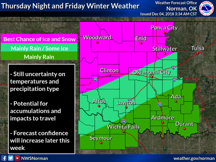
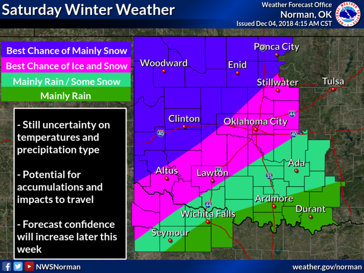
1- WINTER WEATHER IS COMING. As it looks right now based on guidance, we could see a mix of some ice and snow then transition to all snow. Either way, the STORM TRACK is the key issue. 30 miles either way can mean a major difference in what we receive along with what temperatures aloft are at different altitudes. That’s a big one there. This link will help you understand or confuse you on the difficulties of forecasting what type of precipitation we’ll receive at any given location. The atmosphere is never straight lines. https://www.weather.gov/jetstream/skewt_samples
Here is a link to this morning’s discussion- https://forecast.weather.gov/product.php?site=OUN&issuedby=OUN&product=AFD&format=CI&version=1&glossary=1
2- No matter what happens later this week, use good judgement on traveling. Knowing roads could be icy may mean you postpone travel for a few days. You don’t want to get stranded out there. ALSO, if the roads are a little treacherous but you seem to be moving ok, don’t get overconfident and increase your speed. Higher speeds will only get you into the ditch a little quicker and then possibly stuck. We don’t want to see anyone get hurt.
3- Overall, we’ll be ok so just stay tuned to your favorite weather source and we’ll deal with this as we do everything else. Be sure to get our GARFIELD COUNTY EM app. I will be sending out info throughout this event.
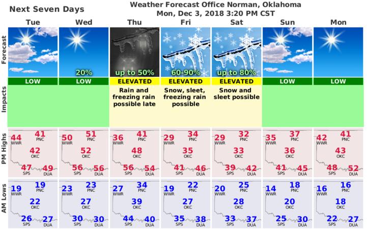
4- Here is your forecast from the NWS/NORMAN;
Tuesday: Mostly cloudy, with a high near 41. Calm wind becoming southwest around 6 mph in the afternoon.
Tuesday Night: Partly cloudy, with a low around 25. Light and variable wind becoming southwest around 6 mph in the evening.
HAVE A SUPER DAY!!
MIKE