0400L-MONDAY UPDATE FROM ENID/GARFIELD COUNTY EMERGENCY MANAGEMENT-12/3/18
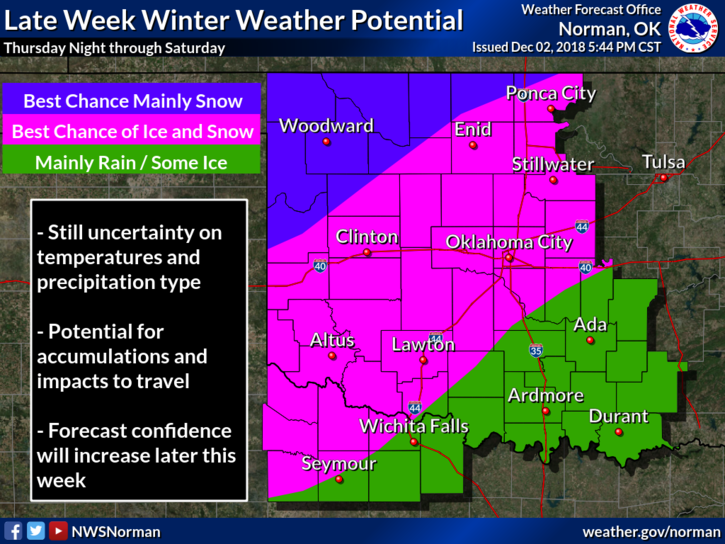
1- Look at the first graph below showing precipitation types for later this week. IT’S GOING TO CHANGE MANY TIMES THIS WEEK. Don’t get hung up on where lines are on ANY map right now. 3 models are stating similarities concerning later this week but with moisture availability differences, timing differences, and the type of precipitation possible, all remains to be seen.
2- It’s going to be cold and we WILL see some sort of winter weather but EXACTLY WHICH TYPE for sure, remains to be seen. I would take some time and sit down and go over your WINTER WX PLAN, HINT-HINT. As the week progresses, better details will come out as to what, where, when, and how much winter weather we will receive. REMEMBER– Don’t believe 1 model run from 1 model this far out and believe the world will end. It won’t. Several models are needed for forecasting, not just one.
3- Read the FORECAST DISCUSSIONS from your local NWS OFFICES HERE– https://gcem.org/links/ and you will get a good idea what they deal with. Make sure the information you believe and share comes from a CREDIBLE Source. All of our regional area offices are listed along with the SPC.
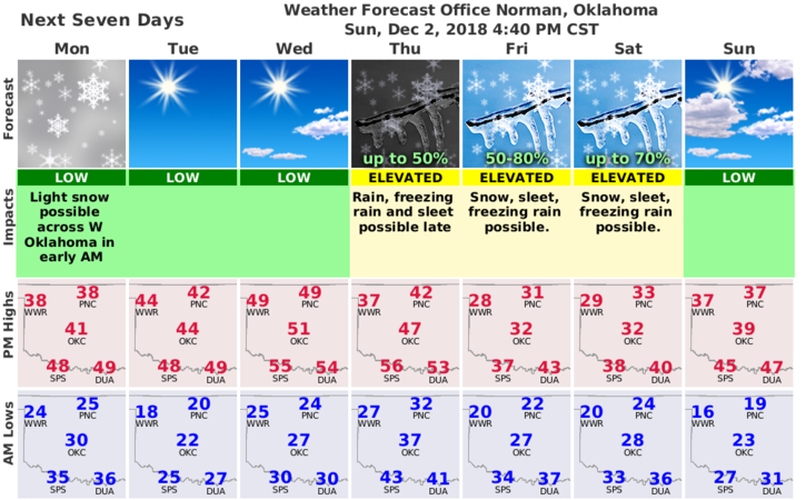
3- Here is your forecast from the NWS/NORMAN;
Today: Mostly sunny with a high near 38. North wind 8 to 13 mph.
Tonight: Mostly clear with a low around 20. North wind 3 to 6 mph.
Be sure to download our GARFIELD COUNTY EM app. You may need it later this week, just sayin.
HAVE A GREAT DAY
MIKE