0400L-TUESDAY OUTLOOK AND INFO FROM ENID/GARFIELD COUNTY EMERGENCY MANAGEMENT-2/5/19
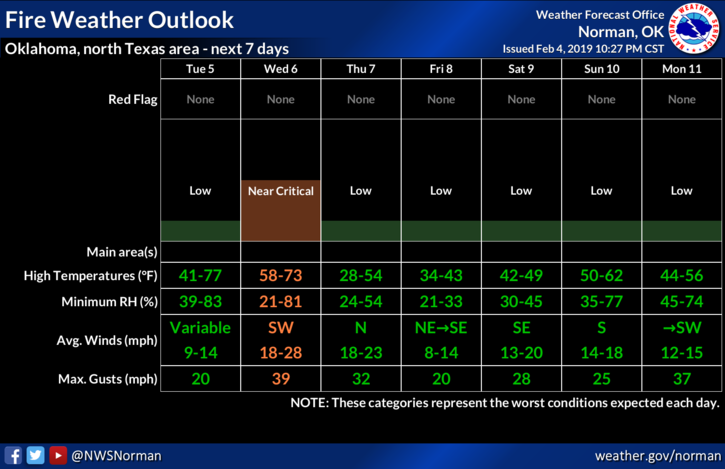
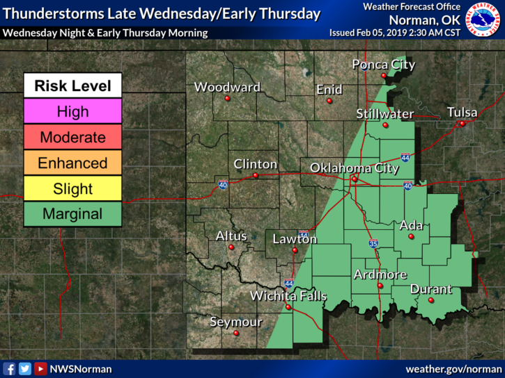
1) FIRE WEATHER AND RAIN CHANCES ARE THE TWO ISSUES OF THE DAY. There is a slight chance for showers later today into tonight. Some models have deviated a little from earlier guidance so severe weather isn’t expected here. We might see some rain but that is a low possibility. The forecast will change some during the day so we’ll watch this closely. As for fire weather, foliage is extremely dry so be careful utilizing anything related to fire. Call 911 if you see smoke or fire. If you plan on traveling in any direction this week, check the forecast of your destination before leaving so you know what to expect.
2) FOOD FOR THOUGHT, many folks seem to feel they are prepared for anything and everything at home. If that’s the case, great!! For many people, the opposite is true. You can sit at home, think and talk through different scenarios, and have somewhat of a plan. This is important. Now, you’re away from home and something happens, WHAT NOW? This is what I would like you to think through from now on. Always have some sort of a plan for emergencies just in case they occur where ever you may be. They will happen and you could be that difference not only for yourself and the family but for others.
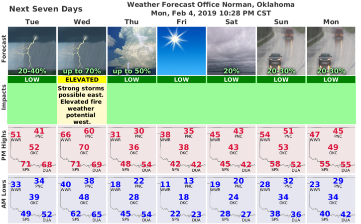
3) Here is your forecast from the NWS/NORMAN;
Tuesday-Mostly cloudy, with a high near 42. East wind 5 to 7 mph.
Tuesday Night-30 percent chance of rain after midnight. Mostly cloudy, with a low around 37. East northeast wind 5 to 8 mph becoming south after midnight.
HAVE A SUPER DAY!!
MIKE