FROM GARFIELD COUNTY EMERGENCY MANAGEMENT
Good morning,
Power is still out in and around the Woodward area. I don’t have accurate totals right now but keep those folks in your thoughts. We could have been in the same boat had we had strong winds so I consider us very lucky. That said we had a great melting system after the ice event as we received around 2-3 inches of rain around the region. In some areas, more. I hope this isn’t a precursor to what spring will be like or the skeeters will really be out of control. More on that later.
As we go into the rest of this week, it should be mild. No major events to really worry about right now. That could change but we’ll wait and see. Be sure and get our GARFIELD COUNTY EM app downloaded and learn how it works as storm season will quickly be approaching. Look at it this way, we are already more than half way through January!!
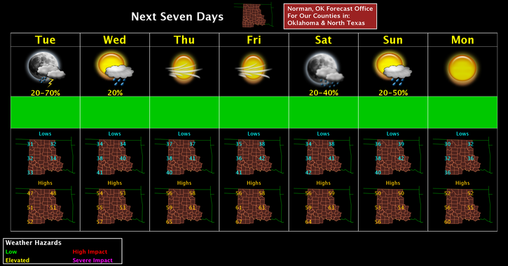
Here is your forecast from the NWS/NORMAN;
Tuesday-Mostly sunny, with a high near 47. Northwest wind 5 to 8 mph.
Tuesday Night-20 percent chance of showers after midnight. Mostly cloudy, with a low around 34. Light and variable wind becoming southwest around 5 mph.
HAVE A SUPER DAY!!
MIKE