TUESDAY UPDATE-0425L-FROM GARFIELD COUNTY EMERGENCY MANAGEMENT.
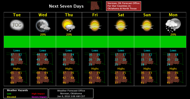
ENJOY TODAY AND TOMORROW! Temps will be in the low to mid 60’s for highs but we will deal with the wind. Late Wednesday night, a cold front will move in and everything goes downhill from there for several days. Highs will be back in the 20’s and 30’s Thursday through at least Monday. A secondary shot of cold air comes in Friday. All precip chances are 20% at least for now based on NWS GUIDANCE.
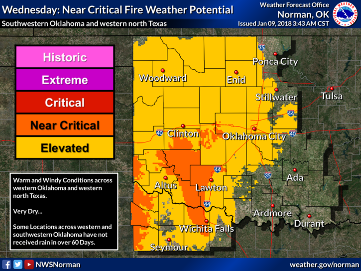
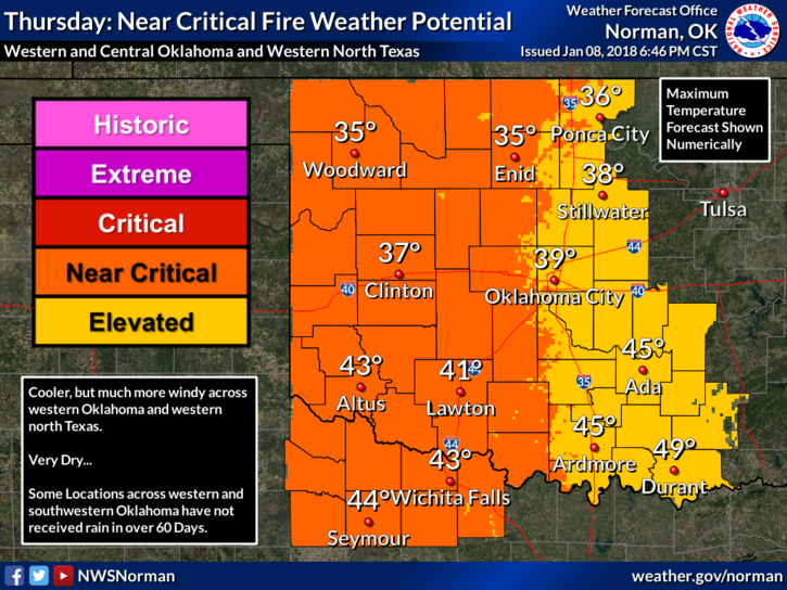
Even though we will be cold, we can still have fires. The FIRE DANGER will be ELEVATED to CRITICAL through the rest of the week. Be careful out there.
Here is your forecast for today from the NWS/NORMAN;
Today-Mostly sunny, with a high near 61. South wind 10 to 18 mph, with gusts as high as 25 mph.
Tonight-Partly cloudy, with a low around 45. South wind 11 to 14 mph, with gusts as high as 20 mph.
HAVE A SUPER DAY!!
MIKE