0350L-TUESDAY OUTLOOK & INFO FROM GARFIELD COUNTY EMERGENCY MGMT-7/21/2020
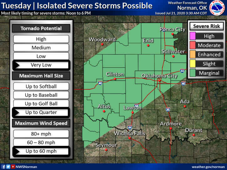
1-MARGINAL RISK for severe weather again today. Storms will persist today as several systems move into and near the area. We can expect gusty winds, quarter size hail, torrential rainfall, and intense lightning when storms do occur. Timing is roughly from noon until 6pm this evening.
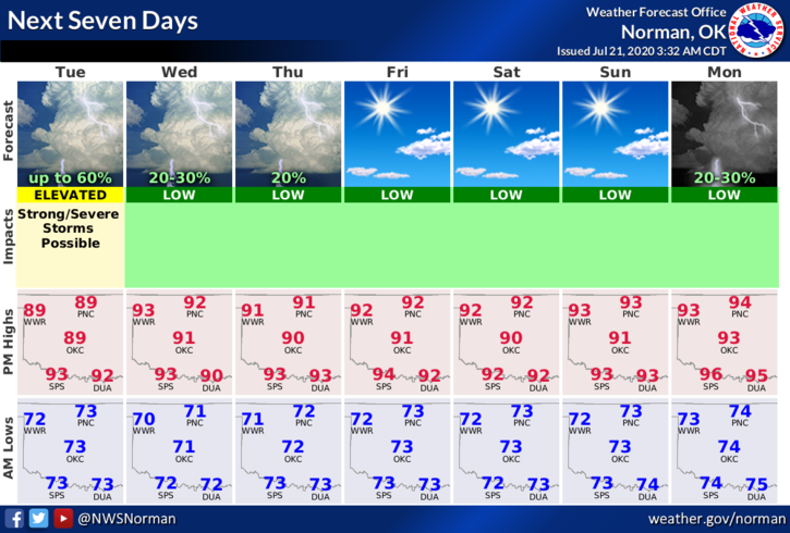
2- I measured just over a half inch of rainfall from yesterday’s almost horizontal rainfall. Let me know what you all received if possible. Overall, we’ll be ok so expect more of the same today. By the way, it will be mostly cloudy and cooler today. Here is your forecast from the NWS/NORMAN;
Today-Mostly cloudy with a chance of thunderstorms until late afternoon. Highs in the upper 80s. South winds around 10 mph. Chance of thunderstorms 50 percent.
Tonight-Partly cloudy. Lows in the lower 70s. South winds around 10 mph.
HAVE A SUPER DAY!!
MIKE