FROM GARFIELD COUNTY EMERGENCY MANAGEMENT-TUESDAY JULY 25, 2017
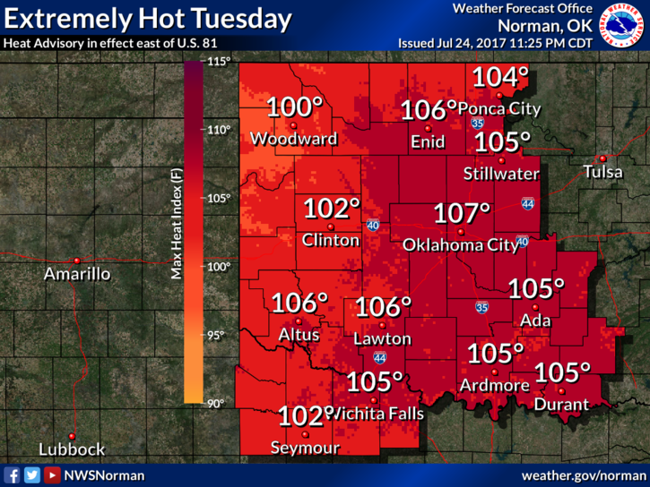
THE NWS IN NORMAN HAS ISSUED A HEAT ADVISORY WHICH REMAINS IN EFFECT FROM NOON TODAY UNTIL 8 PM CDT TONIGHT. ADDITIONALLY, THE HEAT ADVISORY IS ALSO IN EFFECT FROM NOON UNTIL 8 PM CDT WEDNESDAY.
It’s summertime so as stated in many posts before this one, pace yourself outdoors and keep an eye on the kids and outdoor animals.
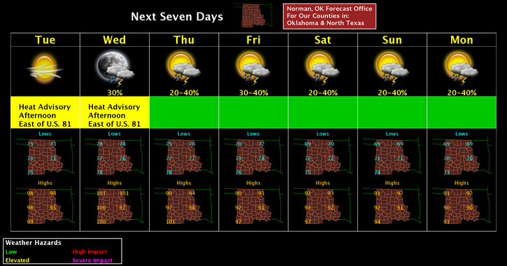
Rainfall looks a little bleak for us until at least Thursday when we have better chances for thunderstorms. After Wednesday, we will cool off, low to mid 90’s, along with those chances for rain. We’ll wait and see what happens. Overall, hang in there, WINTER is on its way!!
Here is your forecast from the NWS/NORMAN;
Tuesday-Sunny and hot, with a high near 99. Heat index values as high as 103. South wind 6 to 11 mph.
Tuesday Night-Mostly clear, with a low around 78. South southeast wind 10 to 13 mph.
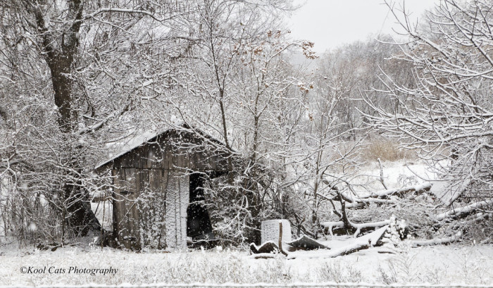
Finally, I hope the winter pic below causes a slight chill within you and takes your mind off the heat.
Have a great day!!
MIKE