0405L-TUESDAY OUTLOOK FROM GARFIELD COUNTY EMERGENCY MANAGEMENT-6/11/19
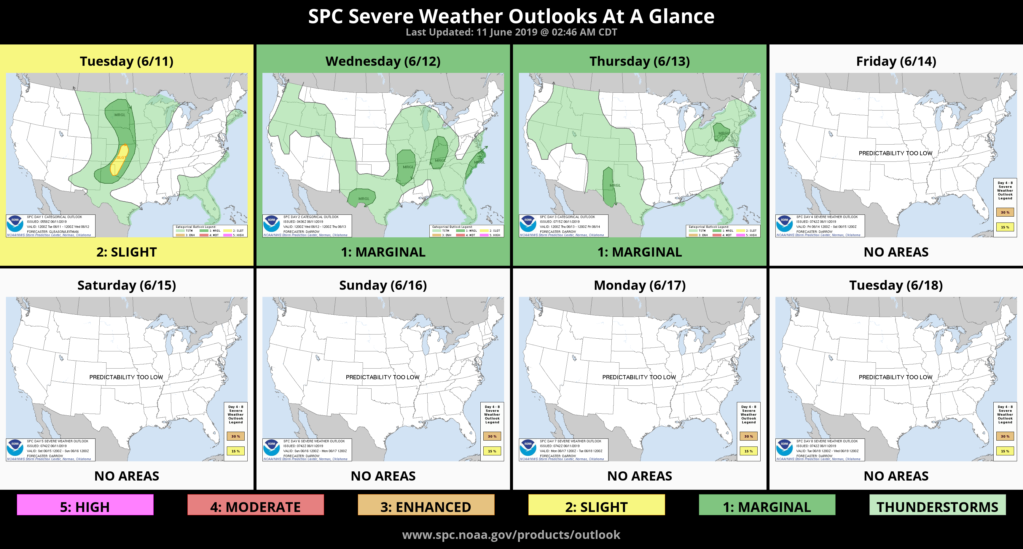
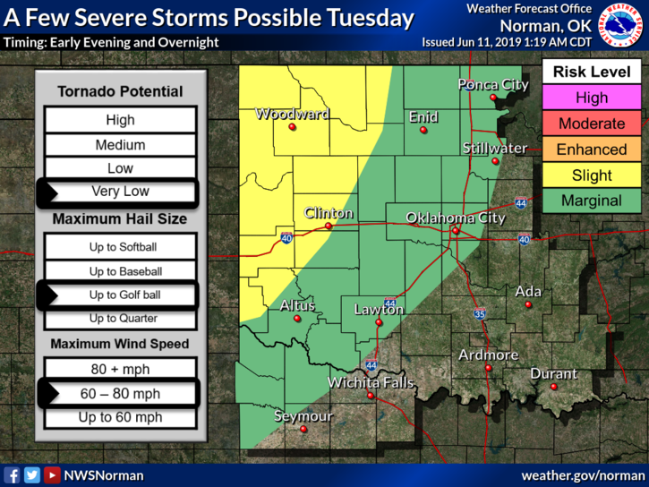
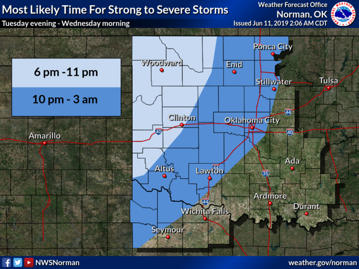
1- MARGINAL RISK for severe weather later today into the overnight hours. Wind and hail will be the main threats if storms do occur. See attached graphics.
2- Here is your forecast from the NWS/NORMAN;
Tuesday-Partly cloudy. Highs around 80. South winds 10 to 15 mph.
Tuesday Night-Partly cloudy with a slight chance of thunderstorms. Lows in the upper 50s. South winds around 10 mph in the evening becoming light and variable. Chance of thunderstorms 20 percent.
A FEW WORDS; as many of you are aware, our Water Rescue team has performed 2 rescues in as many weeks. These two were with some elderly folks that misjudged the water. A barricade was up though. Some comments have been pretty harsh and I haven’t taken them down BUT BE CAREFUL, EVERYONE MAKES MISTAKES. I preach preparedness but also since we don’t deal with the water situation that often, it seems the word BARRICADE will be the norm for a while. Take the time, before we have a recovery call instead of a rescue, to instill into your immediate and extended families to not drive around any barricade whether it says HIGH WATER or CLOSED. Their life will depend on it.
We’re here for those that make mistakes. We would rather you not make that mistake in the first place.
HAVE A GOOD DAY!!
MIKE