0310L-TUESDAY OUTLOOK FROM GARFIELD COUNTY EMERGENCY MANAGEMENT-3/1/22
1- More of the same as yesterday with warm temps and light winds. The short term discussion was short so here it is:
THE VERY WARM LATE WINTER TREND CONTINUES TODAY WITH GENERAL UPPER-LEVEL RIDGING TO THE WEST OF OKLAHOMA. AFTERNOON TEMPERATURES TODAY WILL RANGE 10 TO 20 DEGREES ABOVE AVERAGE EVEN WITH THE CIRRUS STREAM ACROSS THE SOUTHERN HALF OF THE STATE. AT THE SURFACE, THE BROAD AIR MASS CENTER WILL KEEP LIGHT SOUTHWEST WINDS AT THE SURFACE THROUGH EARLY WEDNESDAY.
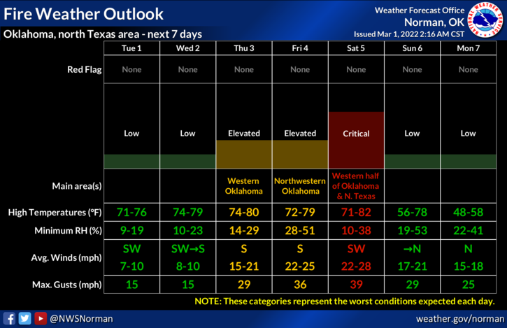
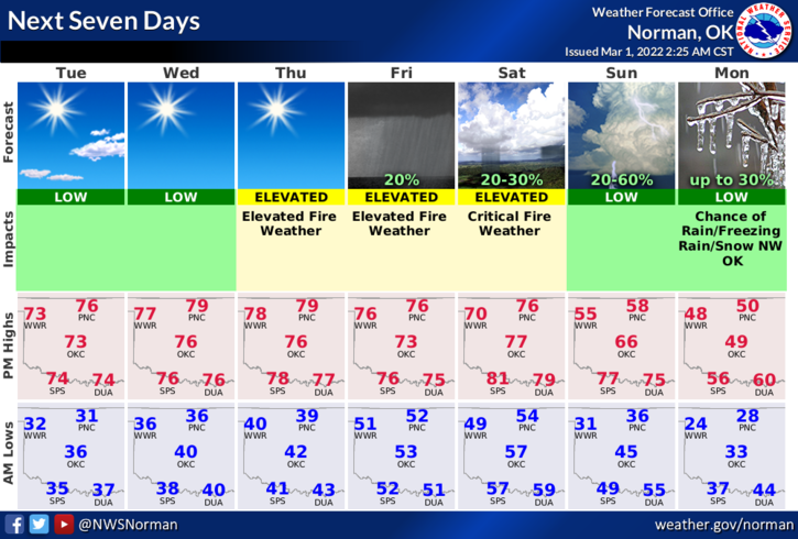
2- Overall, a nice week continues. The FIRE DANGER is rising and windy conditions will begin Thursday through the weekend. Here is your forecast from the NWS/NORMAN;
Today-Sunny. Highs in the mid-70s. Southwest winds 5 to 10 mph.
Tonight-Mostly clear. Lows in the upper 30s. Southwest winds around 5 mph.
HAVE A GOOD DAY.