0410L-TUESDAY UPDATE FROM ENID/GARFIELD COUNTY EMERGENCY MANAGEMENT-5/29/18
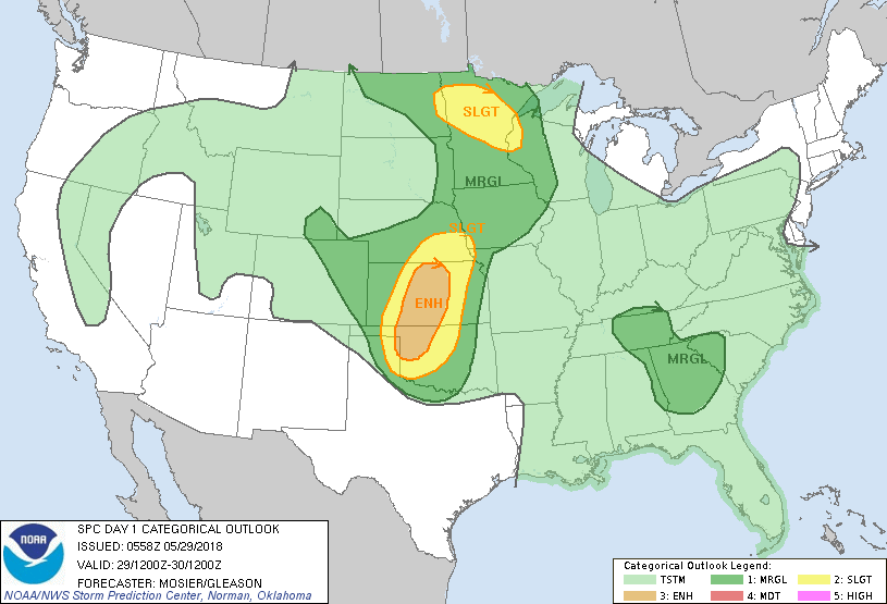
1-SEVERE WX IS EXPECTED THIS AFTERNOON INTO THE EVENING HOURS. WE ARE IN BOTH AN ENHANCED AND SLIGHT RISK AREA. THIS ONLY MEANS THAT IT MAY BE AN INTERESTING AFTERNOON AND EVENING.
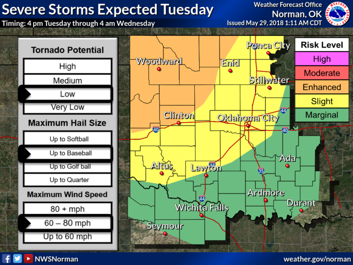
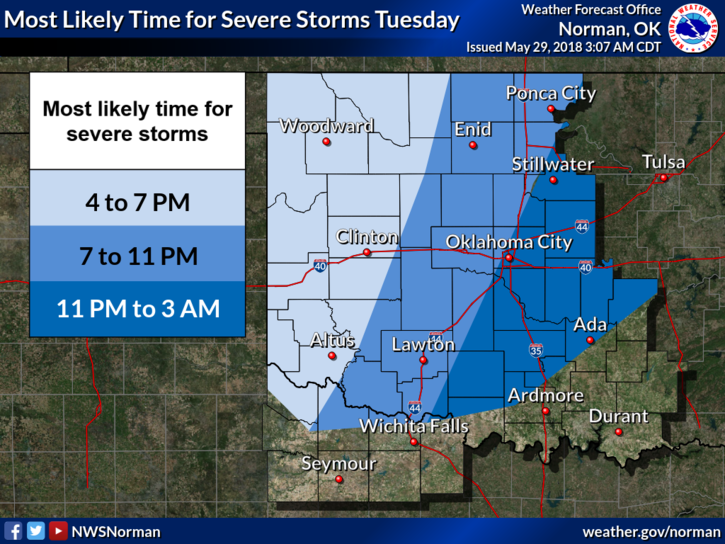
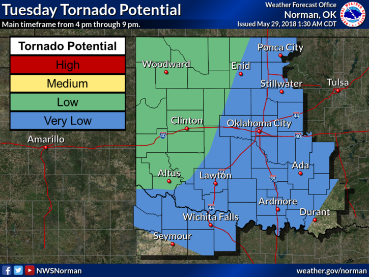
2- The THREATS, per NWS GUIDANCE, are Large Hail-possibly to baseball size, Winds-60 to 80 mph, and a low risk for tornadoes. SEE GRAPH-attached. The tornado threat will be more likely with discrete supercell activity. This may occur farther west but it’s a good idea to be prepared just in case.
3- OVERALL remember these few things; WE CAN’T STOP STORMS. They have occurred for millions of years and will continue to occur. You just need to be prepared for whatever nature throws at you and do what you can for protect yourself and your family.
4- We’ll be ok but be prepared for possibly some rough weather. Make sure you have our GARFIELD COUNTY EM app. You will receive important information directly from us locally and also, LISTEN TO OUR LOCAL RADIO STATIONS.
5- THIS IS OUR PREPAREDNESS GUIDE- https://gcem.org/wp-content/uploads/2017/08/Garfield-County-Family-Preparedness-Guide-2017.pdf
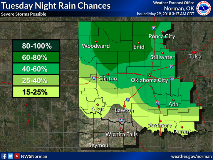
6- Here is your forecast from the NWS/NORMAN;
Tuesday-A slight chance of showers and thunderstorms before 7am, then a slight chance of showers and thunderstorms after 1pm. Mostly sunny, with a high near 92. South southeast wind 8 to 15 mph, with gusts as high as 21 mph. Chance of precipitation is 20%.
Tuesday Night-50 percent chance of showers and thunderstorms. Some of the storms could be severe. Mostly cloudy, with a low around 67. South southeast wind 8 to 14 mph becoming east northeast after midnight. Winds could gust as high as 20 mph. New rainfall amounts between a quarter and half of an inch possible.
HAVE A SUPER DAY AND WE’LL ADVISE AS NEEDED.
MIKE