0400L-TUESDAY OUTLOOK & INFORMATION FROM GARFIELD COUNTY EMERGENCY MGMT-11/5/19
1- Get our GARFIELD COUNTY EM app and be prepared. Without it, you’re not!
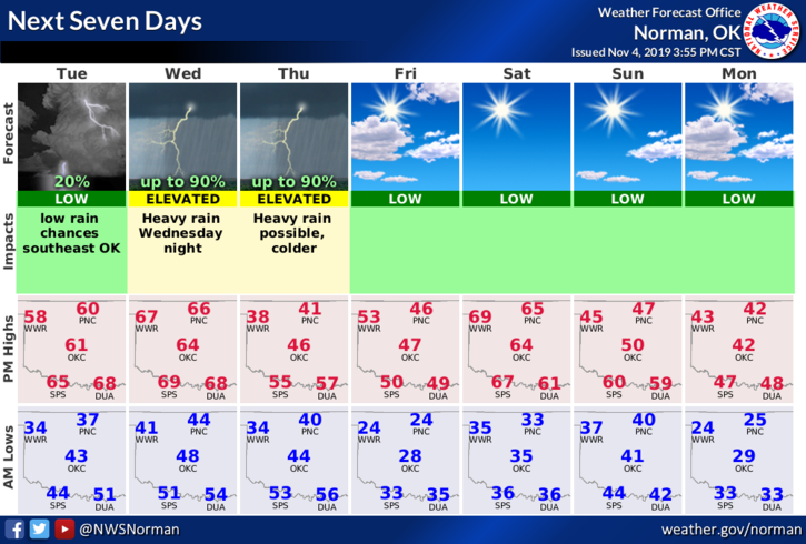
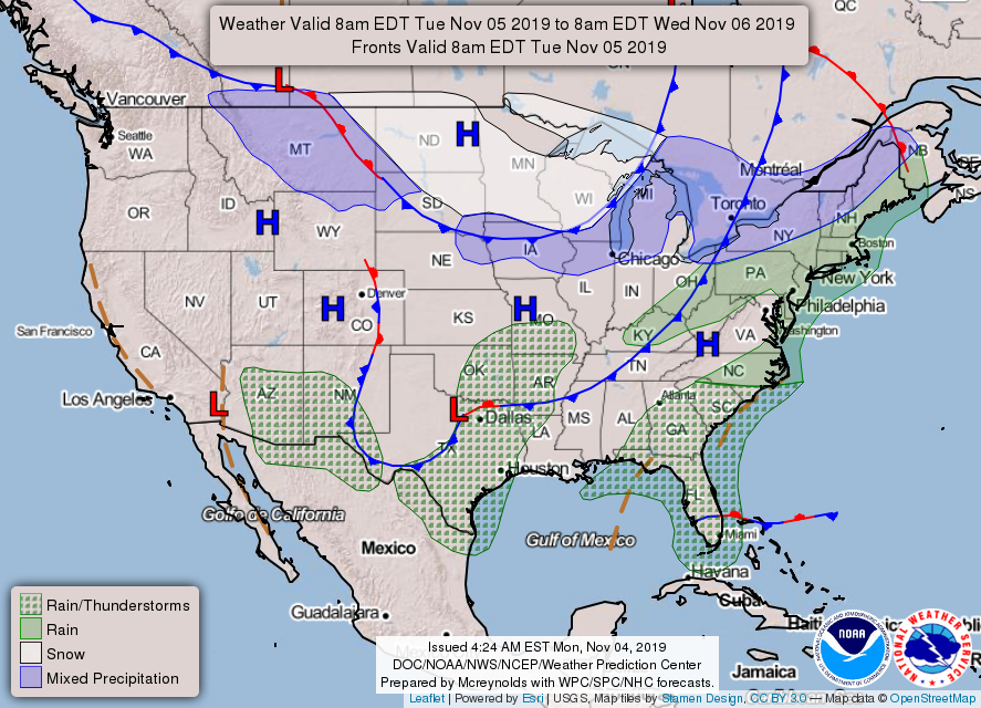
2- Enjoy today and part of tomorrow. A strong cold front is heading our way and it will bring rain, “maybe” a wintry mix Wednesday night, and definitely colder air. Details are constantly changing so we’ll see how this mess comes together. No accumulative snowfall expected just some rainfall.
3- Another cold front is expected in the Sunday-Monday timeframe. We’ll see what happens as that one gets its act together.
4- Here is your forecast from the NWS/NORMAN;
Tuesday- Sunny with highs around 60. East winds around 10 mph.
Tuesday Night-Partly cloudy with lows in the lower 40s. Southeast winds around 10 mph in the evening becoming light and variable.
HAVE A SUPER DAY!!
MIKE