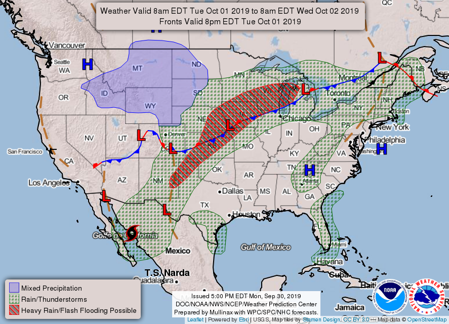
0400L-TUESDAY OUTLOOK & INFO FROM GARFIELD COUNTY EMERGENCY MANAGEMENT-10/1/19
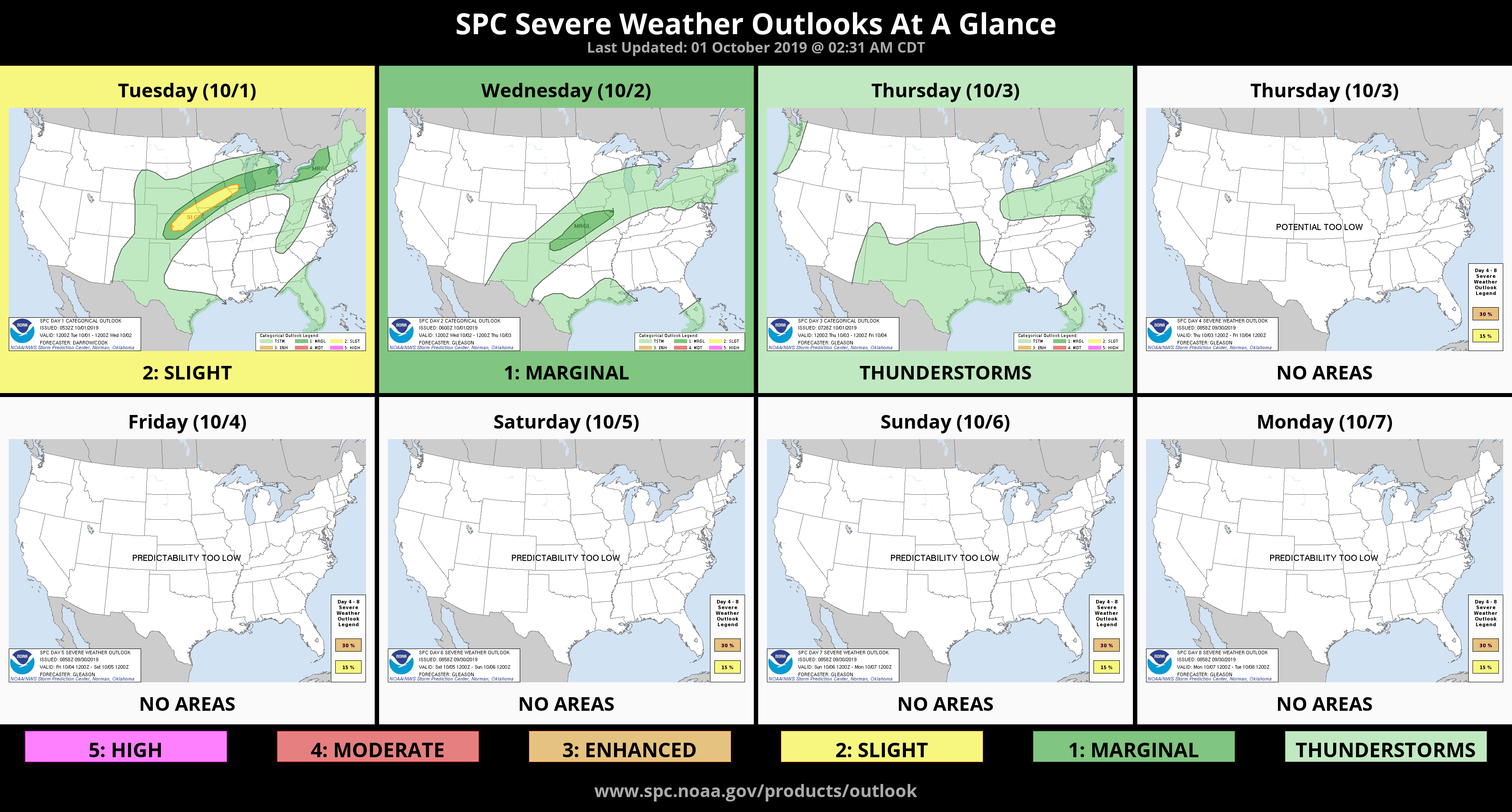
1- After a very warm September, October should be interesting. For those that like cooler weather, it appears Thursday will be our coolest day of the week and thunderstorms are “possible” through at least Sunday. There will also be a chance for severe weather this week with winds and hail being the main threats. One other threat to mention will be torrential rainfall. As long as we have tropical moisture in the region, rainfall will be heavy at times. The potential for flash flooding may be elevated at times too. STAY WEATHER AWARE THIS WEEK!!
2- Here is your forecast from the NWS/NORMAN;
Tuesday-Partly cloudy with highs in the upper 80s. South winds 15 to 25 mph.
Tuesday Night-Partly cloudy. 40% chance of thunderstorms in the evening, then a chance of thunderstorms after midnight. Lows in the lower 70s with south winds 10 to 15 mph.
HAVE A GOOD DAY!!
MIKE