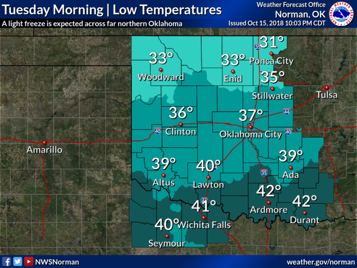
0330L-TUESDAY OUTLOOK FROM ENID/GARFIELD COUNTY EMERGENCY MANAGEMENT-10/16/18
FREEZE WARNING IN EFFECT THIS MORNING UNTIL 9 AM.
1-REMINDER–October 30th– Our 2nd Annual Disaster Resilience Seminar. See details in the middle of the front page at this address– https://gcem.org
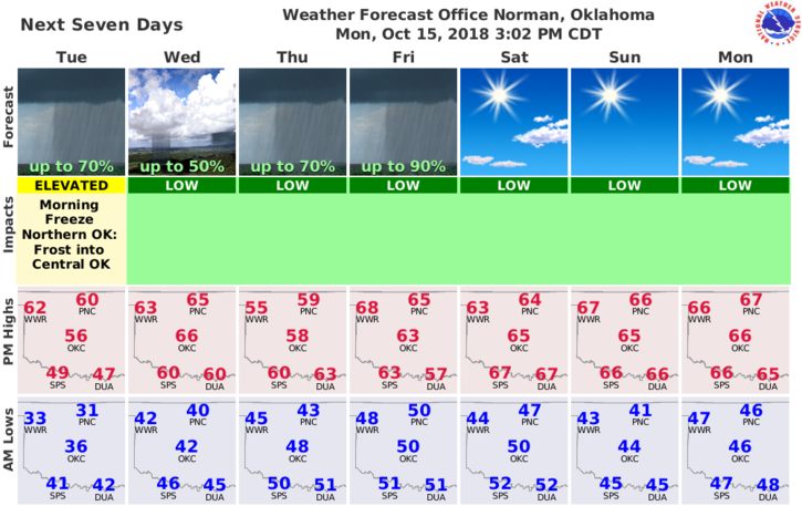
2-We will be warming up gradually this week so expect cool nights and warm days. The next chance for showers for our area looks to be around Thursday. We’ll see how this comes together.
3-Overall, a good week to get out and enjoy some sunshine even though it’s a little cooler.
4- Here is your forecast from the NWS/NORMAN;
Tuesday-Widespread frost before 9 am. Otherwise, mostly sunny with a high near 61. West southwest winds around 6 mph.
Tuesday Night-Partly cloudy, with a low around 41. Calm wind becoming north northwest around 6 mph after midnight.
HAVE A SUPER DAY!!
MIKE