0355L-TUESDAY OUTLOOK FROM GARFIELD COUNTY EMERGENCY MANAGEMENT-10/27/2020
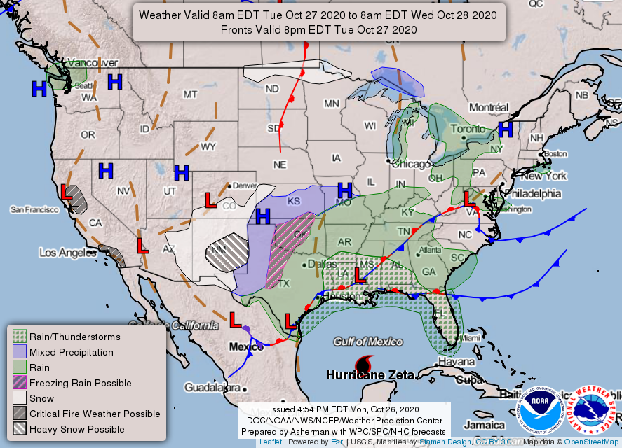
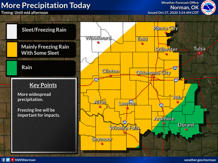
1- ICE STORM WARNING still in effect through Wednesday afternoon. The second wave is moving towards western and southwestern Oklahoma and we are still expecting more freezing rain, drizzle, and sleet today. Guidance states that we SHOULD SEE LESS than yesterday as we received 1/4 to 1/2 inch of ice on Monday. Temperatures aloft dictate the precipitation type so we’ll wait and see what happens as the day wears on.
2- Dangerous driving conditions will continue so please slow down, put those phones down and pay attention to your driving. There were several vehicles that I observed running red lights as they were too busy on their phones to pay attention to their driving. We are recommending that travel be avoided right now until roads clear up in a day or so.
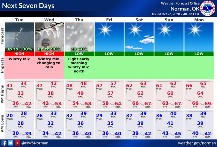
3- Round 3 will occur tomorrow morning with the same issues as we have been experiencing. By Wednesday afternoon, temps should be (slowly) increasing to move us above freezing.
4- GARFIELD COUNTY EM is our notification app. If you don’t have it, you will need it. Stay as prepared as you can. Download it today. There is more information on this app than you would possibly need and you’ll also get NWS Advisories and Warning along with ours as we post information.
5- Here is your forecast from the NWS/NORMAN;
Today-A chance of light sleet and isolated thunderstorms in the morning. Light freezing rain through the day. Rain in the afternoon. Highs in the lower 30s. North winds 10 to 15 mph.
Tonight-Cloudy with a chance of light freezing rain and rain. Lows in the upper 20s. North winds 10 to 15 mph. Chance of precipitation 50 percent.
STAY WARM AND HAVE A GOOD DAY!!
MIKE