0400L-TUESDAY UPDATE FROM ENID/GARFIELD COUNTY EMERGENCY MANAGEMENT-10-9/18
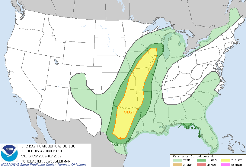
1- MARGINAL RISK for severe storms today with another 1-2 inches of rainfall in the forecast.
2-A cold front will push through later this evening pushing the moisture out giving us a few days of cooler and dryer air then rain chances go back up as another system moves in.
3- There are roads around the area that don’t drain well so while driving, slow down and avoid hydroplaning. This will get you into trouble when you least expect it so stay aware.
4- Overall, we’ll be ok. Here is your forecast from the NWS/NORMAN;
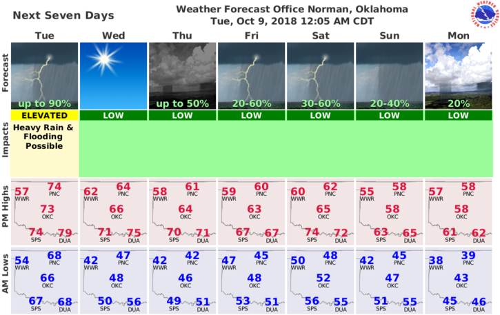
Tuesday-Showers and possibly a thunderstorm. Some of the storms could produce heavy rainfall. High near 70. Southeast wind 7 to 14 mph, with gusts as high as 20 mph. Chance of precipitation is 100%. New rainfall amounts between 1 and 2 inches possible.
Tuesday Night-30 percent chance of showers and thunderstorms before 1am. Cloudy during the early evening, then gradual clearing, with a low around 45. West southwest wind around 13 mph becoming northwest after midnight.
FINALLY- Download our GARFIELD COUNTY EM app. You’re NOT PREPARED without it.
Enjoy the rain and have a good day.
MIKE