0400L-TUESDAY OUTLOOK FROM GARFIELD COUNTY EMERGENCY MANAGEMENT-9/20/22
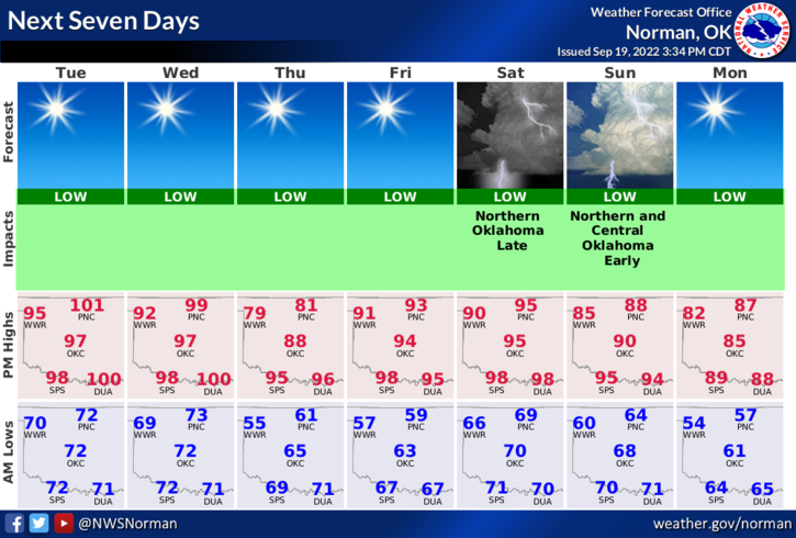
1- The heat will continue for a few more days and then a cold front pushes into the area late Wednesday night into Thursday. We are teased with highs around 80 on Thursday then back into the low 90’s for the early weekend and then back into the mid 80’s to begin the week. Always remember, everything that’s typed here could possibly change. There is a VERY low chance for rain this weekend so water the yard, wash the car and fill the pool for the kids and then maybe it will rain.
2- Overall, we’ll be ok so hang in there and stay cool. Here is your forecast from the NWS/NORMAN;
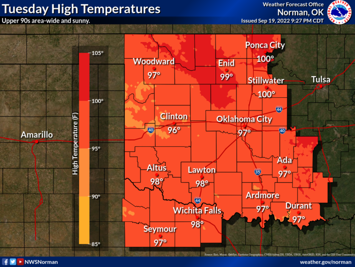
Today-Sunny. Highs in the upper 90s. South winds 10 to 15 mph with gusts up to 25 mph.
Tonight-Mostly clear. Lows in the lower 70s. South winds 10 to 15 mph.
Have a good day!