0350L-TUESDAY OUTLOOK FROM GARFIELD COUNTY EMERGENCY MANAGEMENT-9/24/19
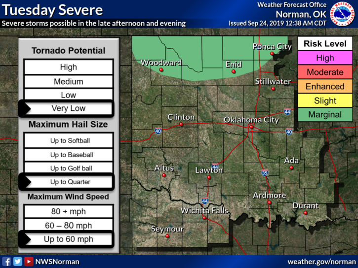
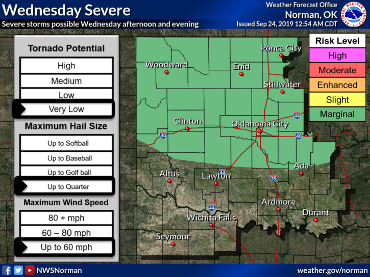
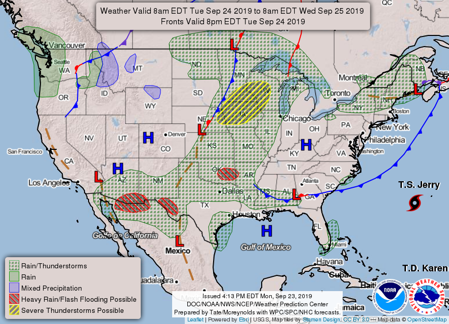
1- MARGINAL RISK for severe weather this afternoon & tonight. If it does occur, torrential rainfall along with localized flooding, strong winds, and possibly hail would be our main threats. We will be in a Marginal Risk again on Wednesday, see graphic attached.
2- If you plan on traveling to the north and northeast like Nebraska into Minnesota, spring-like severe weather will occur with ALL HAZARDS EXPECTED so be careful if you’re going that way.
3- Now would be a good time to download our GARFIELD COUNTY EM app. You’ll get local information from us and advisories and warnings automatically from the NWS.
4- Here is your forecast from the NWS/NORMAN;
Today- Mostly cloudy with a slight chance of thunderstorms in the morning, then partly cloudy in the afternoon. Highs in the upper 80s with south winds 10 to 20 mph. Chance of thunderstorms 20 percent.
Tonight- Partly cloudy. A slight chance of thunderstorms after 7pm. Lows in the upper 60s. South winds 10-20 mph. Chance of thunderstorms 20 percent.
HAVE A GOOD DAY!!
MIKE