0325L-WEDNESDAY OUTLOOK AND INFO FROM GARFIELD COUNTY EMERGENCY MANAGEMENT-9/25/19
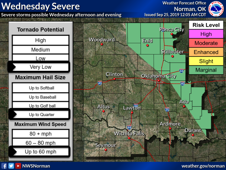
1- MARGINAL RISK for severe weather later today. Torrential rainfall-giving us a flood risk, hail-with any larger storms, and winds-which would most likely be our main threat. Overall, we’ll be ok. We’ll watch and advise as needed.
2- OK, Several folks have sent me a text this morning complaining about the NOAA Alerts on our GARFIELD COUNTY EM app. Significant Weather Advisories are important because storms may be nearing severe levels. This is why they are sent. If you DON’T want to receive any alerts from the NWS, go to SETTINGS, then Notification settings, scroll down to NOAA WEATHER ALERTS and turn it off. You can turn it back on later if you want. If you forget, don’t complain that you’re not receiving any alerts. Welcome to my world!!!
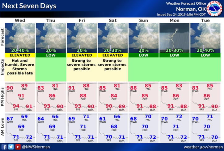
3- Here is your forecast from the NWS/NORMAN;
Today-Mostly sunny. Highs in the lower 90s with south winds around 10 mph. Heat index will be in the upper 90s.
Tonight-Partly cloudy with a 40% chance of thunderstorms. Lows in the mid-60s with south winds around 10 mph shifting to the east after midnight.
HAVE A GOOD DAY.
MIKE