0440L-WEDNESDAY UPDATE FROM ENID/GARFIELD COUNTY EMERGENCY MANAGEMENT-4/18/18
1- WIND ADVISORY TODAY UNTIL 1300L (1PM). WINDS OR WIND GUSTS OF 40+ MPH ARE POSSIBLE. Winds will be gusty all morning and lay down somewhat, this afternoon.
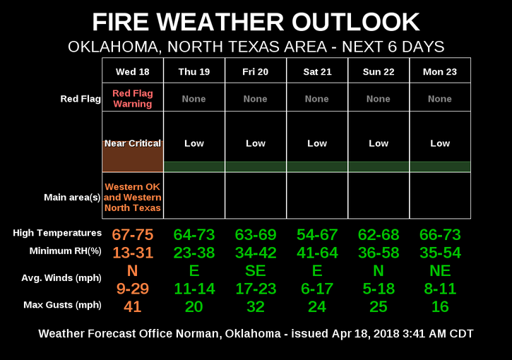
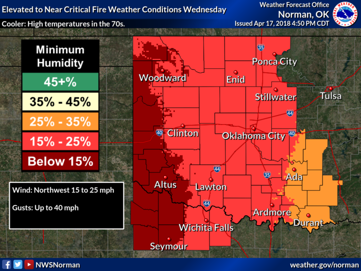
2- RED FLAG FIRE WARNING IN EFFECT FOR THE WESTERN 1/3 OF OKLAHOMA. GARFIELD COUNTY IS “NOT” INCLUDED, AS OF THIS POST, BUT WE ARE IN AN ELEVATED TO CRITICAL FIRE DANGER TODAY.
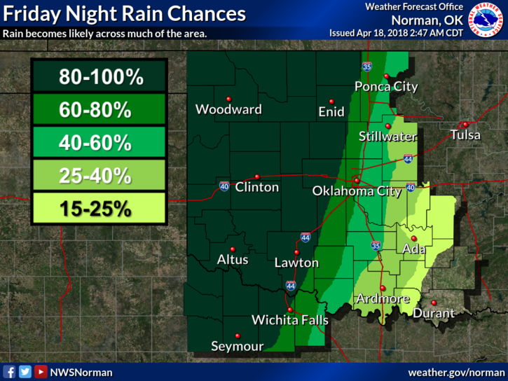
3-Rain chances Friday evening into Saturday are 70 to 80% PER GUIDANCE. I hope this occurs.
4-TASK FORCE STRIKE TEAM UPDATE– We sent Team 3 to relieve Team 2 late last night to the OAKWOOD area where they continue to fight fire with other task force groups. Cedar tree fires can’t be fought up close. You have to allow them to burn then put out the fire around the perimeter. They burn too hot to be up close. That said, Team 3 will come home sometime early this morning and Team 1 will be remain on stand-by for deployment until re-evaluations are conducted in the fire areas. The Garfield County Task Force Coordinator and E.M. officials will meet this morning to determine our strategy, so to speak, and hopefully more sleep will be in that plan. Sorry, had to put a little humor in here.
5- I’ll do another short video this morning explaining some things. I’ll try to keep it shorter than yesterday.
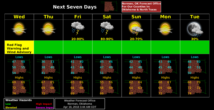
6- Here is your forecast from the NWS/NORMAN;
Wednesday-Sunny with a high near 72. North-Northwest winds 20 to 30 mph gusting to 40 mph.
Wednesday Night-Clear, with a low around 37. North wind 5 to 15 mph.
REPORT ANY SMOKE OR FIRE TO 911
MIKE