FROM GARFIELD COUNTY EMERGENCY MANAGEMENT
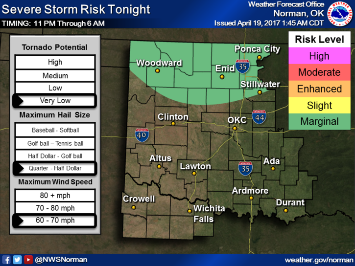
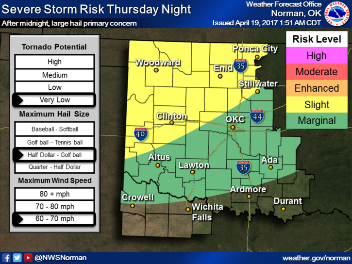
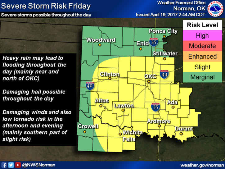
More rain is coming and the “possibility” of some flooding could occur over the next 2-3 days. With fronts, troughs, warm fronts, low and mid-level jets all involved, it appears things may get interesting. Each day, there will be a threat for severe weather in our area with winds and hail being the main threats. Yes, there is a low threat for tornadoes but that will be with initial convection if that remains discreet. All that means is if cells go up and they remain the only one in that area, the “t” threat MAY be elevated. It all depends on the environment around the storms. We’ll keep an eye out on that one.
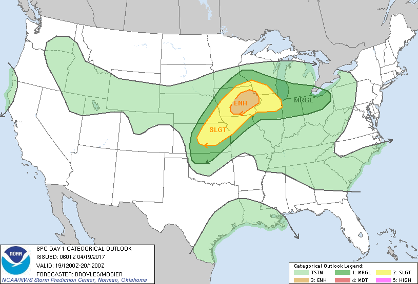
Overall, just be prepared for a few storms, maybe some hail and strong winds over the next several days and know that we are watching. I am attaching some graphs this morning and hopefully they fall into the right order. Read each one carefully noting the day at the top of each graph.
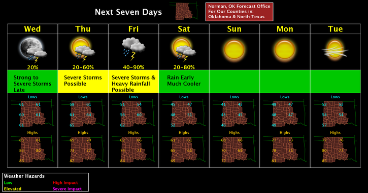
Here is your forecast from the NWS/NORMAN;
Wednesday-Mostly sunny, with a high near 80. South wind 13 to 22 mph, with gusts as high as 31 mph.
Wednesday Night-30 percent chance of showers and thunderstorms after 1am. Increasing clouds, with a low around 58. South wind 13 to 18 mph becoming east northeast 6 to 11 mph after midnight. Winds could gust as high as 25 mph.
Download our app to stay up with the latest from your warning team. The app is GARFIELD COUNTY EM.
HAVE A SUPER DAY!!
MIKE