0400L-WEDNESDAY UPDATE FROM ENID/GARFIELD COUNTY EMERGENCY MANAGEMENT-4/25/18
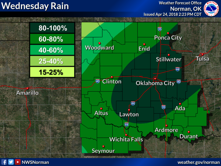
1-Periods of rainfall are expected off and on during the day. No severe weather is anticipated.
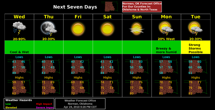
2-Clearing should occur later today and it will be colder tonight. Another system is expected Thursday similar to todays so it appears severe possibilities will be very minimal.
3- Next week a pattern change might occur changing NW flow to the SW. If this occurs, our severe weather potential will increase. There are several things that depict severe. They are; 1 inch hail, winds in excess of 58 mph, and tornadoes. Any of which could depict severe weather. Conditions have to be just right for the latter so we’ll watch all of this carefully and see what Mother Nature brings. This would be a good time to get our GARFIELD COUNTY EM app. IT’S FREE! If you live in Garfield County and you don’t have it, you’re NOT prepared. Purchase a NOAA Weather Radio while you’re at it too.
4- Here is your forecast from the NWS/NORMAN;
Wednesday-Showers with isolated thunderstorms in the morning, then a slight chance of showers and thunderstorms in the afternoon. Cooler. Highs in the upper 50s. Northwest winds around 15 mph with gusts up to 25 mph. Chance of precipitation 80 percent.
Wednesday Night-Mostly clear. Lows in the upper 30s. North winds 10 to 15 mph in the evening becoming light and variable.
HAVE A GREAT DAY!!
MIKE