0415L-THURSDAY UPDATE FROM ENID/GARFIELD COUNTY EMERGENCY MANAGEMENT-4/26/18
1- AFTER TONIGHT, you are going to love the next several days; warm days, mild nights, light winds, little gnats flying around your head, and maybe a skeeter or two. Concerning the last 2 things, you may want some citronella sitting around.
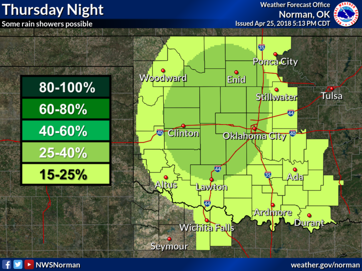
2-Tonight- we have a chance for showers. NO SEVERE WX is expected. Rest easy we’ll be ok.
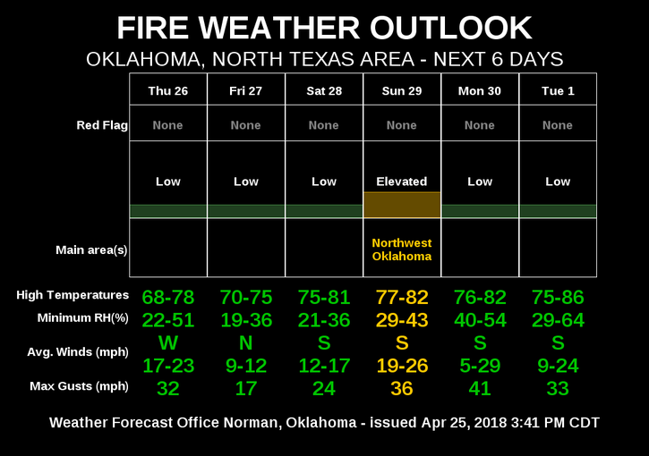
3- YES-WE ARE STILL IN A BURN BAN. I am NOT yelling. Pass this around. Until we green up more and in MY opinion, receive another round of good rainfall, we should stay in the BURN BAN.
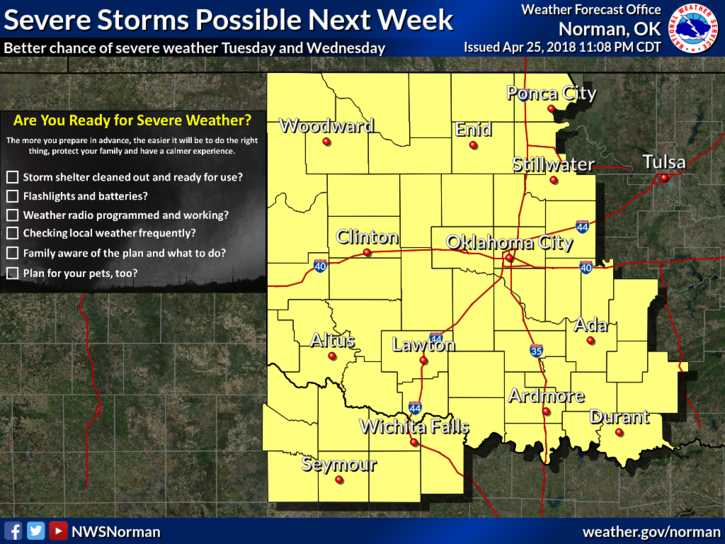
4- NEXT WEEK, a pattern change looks likely. This means that our possibility for severe wx goes up. By the way, WX=WEATHER. As changes occur, the fear mongers do their best to panic everyone by posting false forecasts. BE CAREFUL WHO YOU BELIEVE AND TRUST. I am not talking about the TV folks right now; I am talking about those social media experts that rely on 1 model to predict the end of the world in a day, week, month or year. Until the STORM PREDICTION CENTER (SPC) begins to talk about pending severe events, don’t pay much attention to the hype. Your anxiety level doesn’t need to be elevated this far out. As long as you’re PREPARED, you’ll be ok. The NWS/SPC and EGCEM will advise accordingly.
5- Here is your forecast from the NWS/NORMAN;
Thursday-Sunny, with a high near 70. Light and variable wind becoming southwest around 6 mph in the morning.
Thursday Night-30 percent chance of showers before 1am. Mostly cloudy, then gradually becoming mostly clear, with a low around 42. North wind 5 to 15 mph.
HAVE A SUPER DAY!!
MIKE