0310L-WEDNESDAY OUTLOOK FROM GARFIELD COUNTY EMERGENCY MANAGEMENT-8/16/23
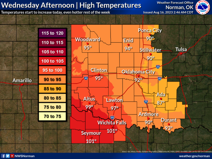
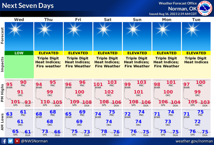
* Another WARMER but mild day expected with no storms. Dewpoint temps will be in the low to mid 60s and relative humidity will get down into the low 30% area. Add 10-20 mph winds to this and quite a few very dry areas out there, our FIRE DANGER will be up a bit today and increasing as we head for the weekend. We do have a front that will push into the region Thursday but no rain is expected with that, just a wind shift. The weather between now and Sunday should be similar to today except for the temps. They will increase into the 100’s by Thursday or Friday. STAY COOL!
*If you see smoke or fire, call 9-1-1 immediately so the proper response can be sent.
* Overall, we’ll be ok so here is your forecast from the NWS/NORMAN;
Today-Sunny. Highs in the lower 90s. South winds 10 to 15 mph with gusts to 21 mph.
Tonight-Mostly clear. Lows in the upper 60s. South winds 10 to 15 mph with gusts to 20 mph.
*Download our GARFIELD COUNTY EM app and click on the GCEM Blog icon. You will find my daily posts there AND on the front page of our website at https://gcem.org
HAVE A GOOD DAY!