0340L-THURSDAY OUTLOOK FROM GARFIELD COUNTY EMERGENCY MANAGEMENT-12/31/2020
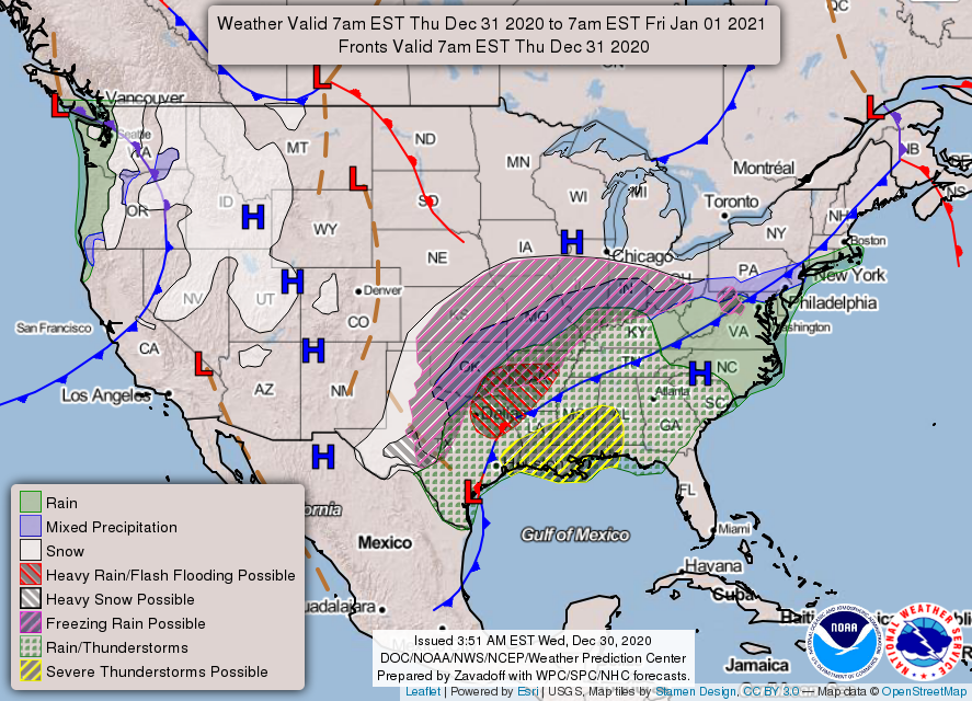
WINTER STORM WATCH IN EFFECT FROM NOON TODAY UNTIL NOON FRIDAY. This may change so we’ll advise as needed. REMEMBER- Forecasts will change several times during the day.
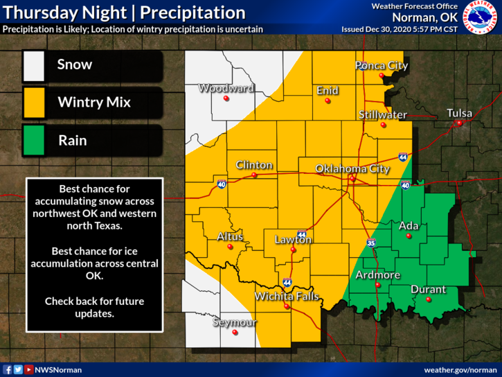
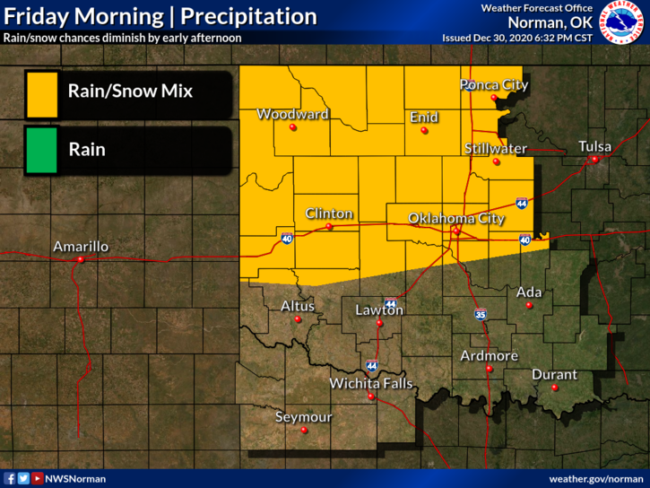
1-Winter weather may not occur here until later into the evening hours. Models are still not in total agreement so we’ll have to watch this closely. Also, depending on the track as of right now at 0300, it looks like the higher snow probability could occur just to our west putting us in that area where a little variance could make a big difference. Major impacts weather-wise during the day aren’t expected but OVERNIGHT is a different ballgame since this upper low has slowed down.
2- We do expect a period of rain, possibly freezing rain OVERNIGHT and as the atmosphere cools, we’ll see a transition to sleet and then snow. We could see ¼ inch of ice or so with any freezing rain and then we could see 2-4 inches of snow on top of that and again, OVERNIGHT, most likely after midnight into the morning hours. The worst part of this may be the winds. They are forecast to be 15-20 mph with higher gusts. Wind and ice can become an issue really quick. Be prepared and make sure you have our GARFIELD COUNTY EM app.
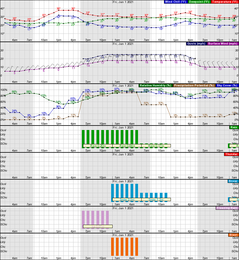
3- I have put several different graphs on here but an idea on timing, as of early this morning are depicted in the forecast graph. No matter what happens later today, tonight, and overnight, when the winter weather sets in, it’s going to get slick really quick especially on elevated surfaces. Use EXTREME CAUTION while driving and especially tonight, DO NOT DRINK AND DRIVE.
4- OVERALL, WE’LL BE OK. We have faced this before so just make sure you are prepared and we’ll see how temps rebound over the weekend into next week.
HAVE A GOOD DAY!!
MIKE