0415L-WEDNESDAY UPDATE FROM GARFIELD COUNTY EMERGENCY MANAGEMENT-2/21/18
**WINTER WEATHER ADVISORY IN EFFECT FROM 0600L THIS MORNING UNTIL 2400L TONIGHT. **
1- We can expect roughly 1/10th of an inch of ice and possibly more this afternoon and possibly more tonight. EVERYONE should prepare for this. DON’T PANIC but at least be prepared for the possibility of a few power outages. This event isn’t major but it could cause some inconveniences’ here and there for a little while. If you have special needs that require power, make sure your BACKUP PLAN is in place JUST IN CASE.
2-DRIVERS!! SLOW DOWN. I saw many folks end up in the ditch because OVERCONFIDENCE gets the better of you. As stated yesterday, ICE MAKES A GOOD DRIVER LOOK BAD SOMETIMES.
3- It only takes a light glaze of ice to cause major driving issues. Today, the surface is already below 32 degrees. Water will freeze immediately so again, BE EXTREMELY CAREFUL AND IF YOU DON’T HAVE TO BE OUT LATER TODAY, STAY HOME.
4-On a lighter note, we will warm up over the weekend and the roads will be clear.
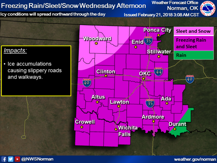
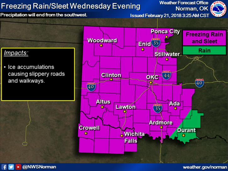
5- Here is your forecast from the NWS/NORMAN;
Wednesday-Snow, freezing rain, and sleet likely after noon. Cloudy, with highs near 29. North northeast wind 10 to 20 mph gusting to 25 mph. Chance of precipitation is 60%. New ice accumulation of less than a 0.1 of an inch possible. Little or no snow and sleet accumulation expected.
Wednesday Night-Freezing rain and sleet, mainly before midnight. Low around 25. North northeast winds 5 to 15 mph gusting to 20 mph. Chance of precipitation is 90%. New ice accumulation of less than a 0.1 of an inch possible. Little or no sleet accumulation expected.
I’ll advise over the GARFIELD COUNTY EM app as needed throughout the day.
MIKE