0350L-WEDNESDAY OUTLOOK & INFO FROM GARFIELD COUNTY EMERGENCY MGMT-1/29/2020
GARFIELD COUNTY EM. This is our emergency notification app. If you don’t have it, you will need it so download it today. PREPAREDNESS=RESILIENCE
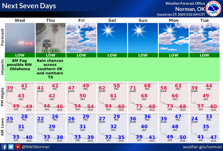
1- FREEZING FOG may be around this morning so when driving, use extreme caution. Anything that appears wet may be slick so be careful. We ended up with 1.2 inches of rainfall on Tuesday with only a trace of sleet and snow. For those that really want snow, maybe next time.
2- Overall, we’ll be ok so enjoy the cooler weather at least for now. Another storm system may impact the area in the Thursday/Friday timeframe. We’ll see what happens.
3- Here is your forecast from the NWS/NORMAN;
Today-Decreasing clouds with patchy fog early in the morning. Highs around 40 with north winds around 10 mph.
Tonight- Mostly cloudy with lows in the mid-20s. Light and variable winds.
Have a good day!!
MIKE