WEDNESDAY OUTLOOK FROM GARFIELD COUNTY EMERGENCY MANAGEMENT-7/13/22
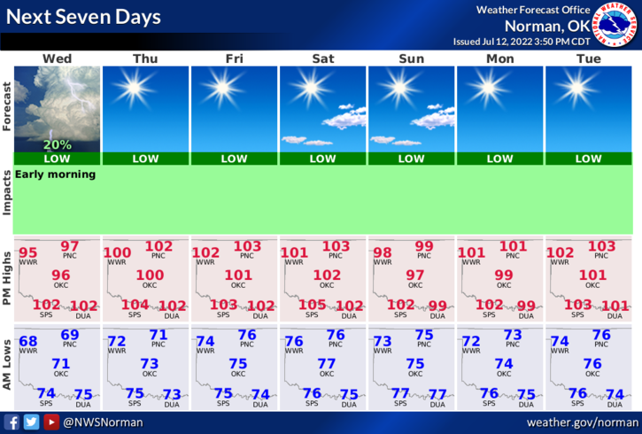
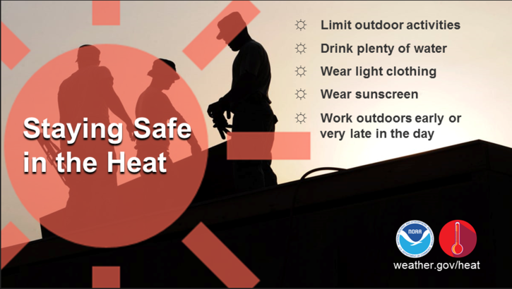
1- HOT, HOT, HOT Need I say more. Cooler at night of course. High temps will range from 98-104 for the next week and overnight lows will range in the low to mid 70s. Not much we can do about this so do your best to stay hydrated and if you need to be outdoors, take breaks, and cool off as needed.
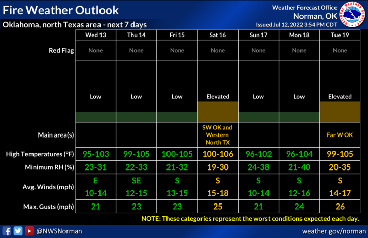
2- No rain in sight so now I will be making FIRE DANGER STATEMENTS for the foreseeable future starting with the following:
a- even though some grass is green if you step on it and it crunches, it’s dry and will burn
b- if humidity is low, don’t through cigarette butts out of the window of your vehicle. They CAN start fires
c- if welding, take precautions to prevent fires from starting along fence lines out there
d- if you see fire and smoke, CALL 911 IMMEDIATELY so the proper response can be sent.
3- Here is your forecast from the NWS/NORMAN;
Wednesday-Mostly sunny. A slight chance of showers and thunderstorms in the morning. Highs in the upper 90s. East winds 5 to 10 mph. Chance of rain 20 percent.
Wednesday Night-Mostly clear. Lows in the lower 70s. Southeast winds 5 to 10 mph.
4- Stay cool, hydrate properly, and have a good day!