0340L-WEDNESDAY OUTLOOK FROM GARFIELD COUNTY EMERGENCY MANAGEMENT-7/14/21
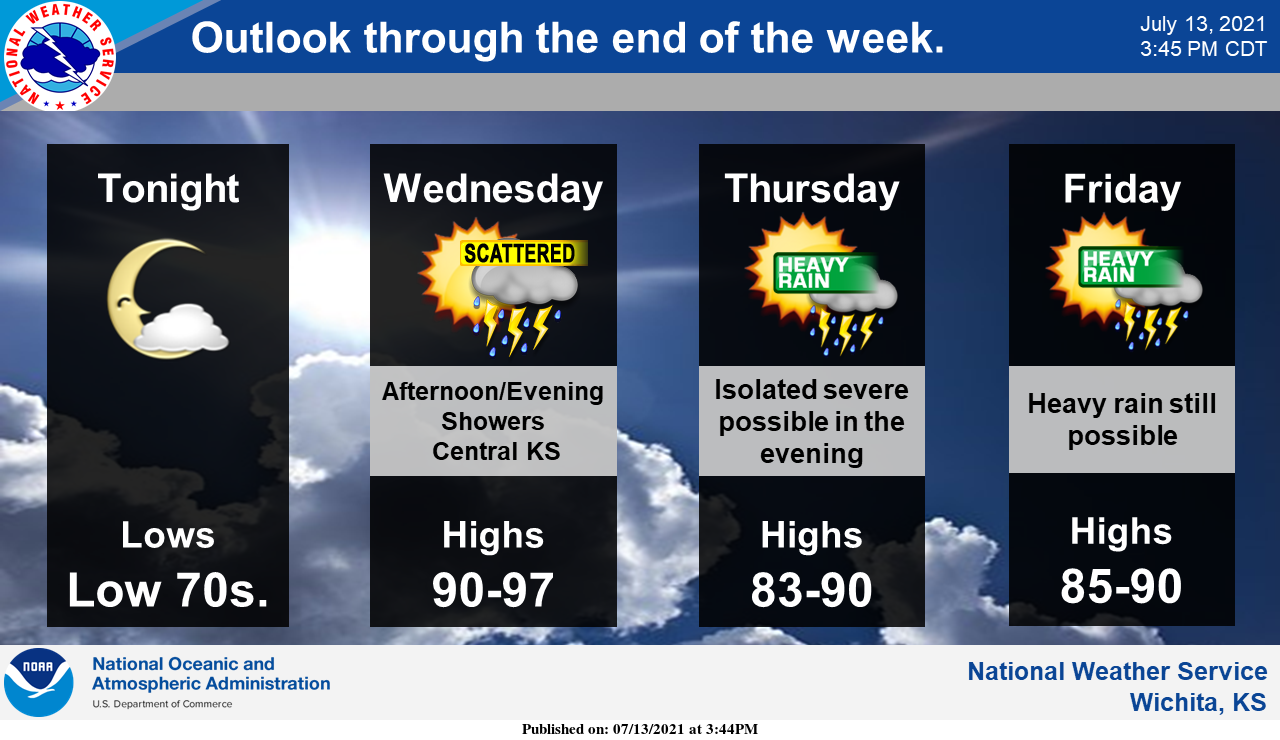
I AM ADDING A GRAPHIC FROM THE NWS WICHITA TODAY ALONG WITH NORMAN.
1- Hot, humid, and windy with the HEAT INDEX in the upper 90s. Tuesday’s skies looked hazy as moisture transport began. We will really feel the humidity today so use caution while working outside and stay hydrated.
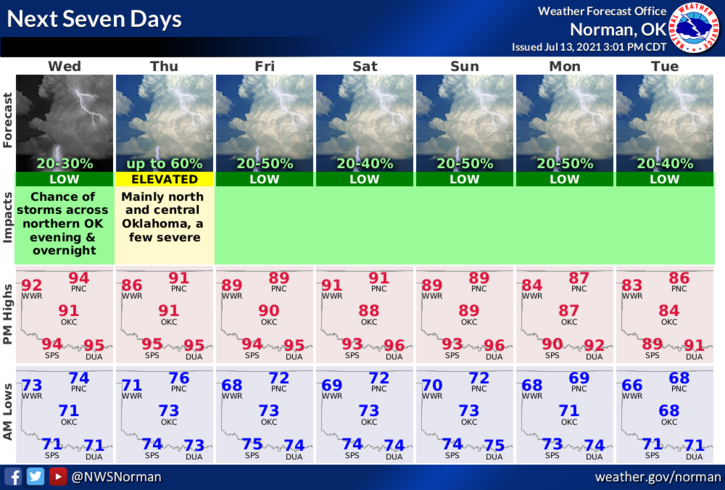
2- Thunderstorms come back into the forecast tomorrow afternoon through early next week. It won’t rain all of the time but that chance will be around. On the days it does rain, torrential rainfall can be expected along with gusty winds and possibly some hail. We’ll just have to wait and see how all of this mess comes together for the rest of the week and weekend. Overall, we’ll be ok so here is your forecast from the NWS/NORMAN;
Wednesday-Mostly sunny, with a high near 94. Heat index values as high as 97. South wind 10 to 15 mph increasing to 15 to 25 mph in the afternoon. Winds could gust as high as 31 mph.
Wednesday Night-Partly cloudy, with a low around 74. South wind 15 to 20 mph, with gusts as high as 25 mph.
3- Be sure and download our GARFIELD COUNTY EM app. It just might save your life!
HAVE A GOOD DAY!!
MIKE