0340L-WEDNESDAY OUTLOOK FROM GARFIELD COUNTY EMERGENCY MANAGEMENT- 7/20/22
OUR TASK FORCE FOLKS ARE HOME. WE MAY RE-DEPLOY IN A FEW DAYS DEPENDING ON AVAILABILITY.
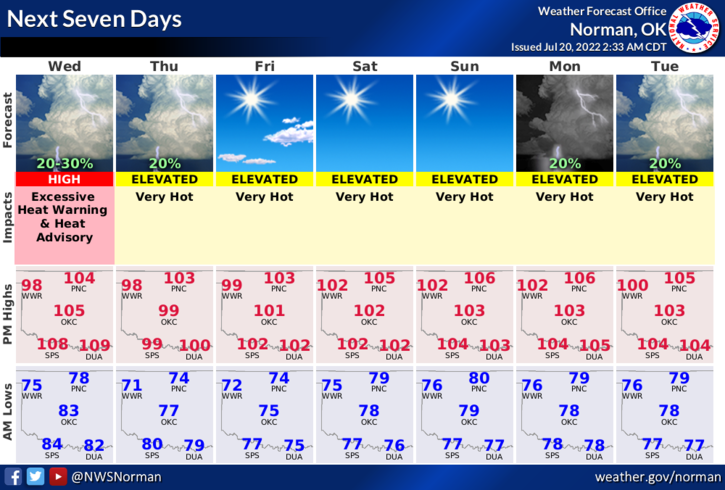
1- HEAT ADVISORY in effect from 1 pm this afternoon until 8pm this evening.
2- Here is your forecast from the NWS/NORMAN;
Today-Partly sunny. Hot with highs around 104. East winds 10 to 15 mph.
Tonight-Mostly cloudy in the evening, then partly cloudy with a slight chance of showers and thunderstorms after midnight. Lows in the mid-70s. East winds 10 to 15 mph. Chance of rain 20 percent.
3- Tuesday was a very warm day, highest official temps showed the Lahoma Mesonet site at 112 the same temp at the base. Breckinridge was at 111. It was also the first time in the history of the Mesonet that every station in the state was over 100 degrees. As I type, its 94 degrees out there at 0255L and this reminds me of at least 3 past heatwaves we’ve had where temps during the night were in the 90s or higher. Yes folks, this has happened several times in the past. As we move forward this week and for the rest of the summer, it will be hot. Just stay hydrated and pay attention to how you are feeling.
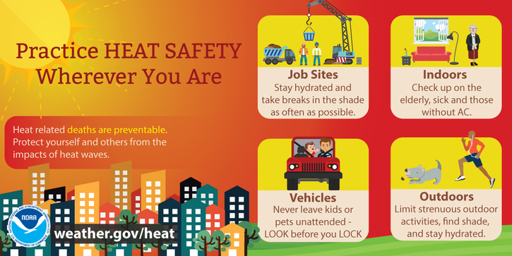
4- Overall, we’ll be ok but take the necessary precautions to protect yourself, children, and don’t forget your pets.
HAVE A GOOD DAY!