0400L-TUESDAY OUTLOOK FROM GARFIELD COUNTY EMERGENCY MANAGEMENT-7/19/22
1- EXCESSIVE HEAT WARNING IN EFFECT FROM NOON TODAY UNTIL 9PM THIS EVENING.
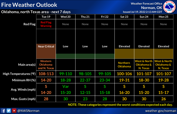
* WHAT…DANGEROUSLY HOT CONDITIONS WITH HEAT INDEX VALUES UP TO 111 EXPECTED.
* WHERE…PORTIONS OF CENTRAL, NORTHERN, NORTHWEST, SOUTHWEST AND WESTERN OKLAHOMA AND NORTHERN TEXAS.
* WHEN…FROM NOON TODAY TO 9 PM CDT THIS EVENING.
* IMPACTS…EXTREME HEAT AND HUMIDITY WILL SIGNIFICANTLY INCREASE THE POTENTIAL FOR HEAT RELATED ILLNESSES, PARTICULARLY FOR THOSE WORKING OR PARTICIPATING IN OUTDOOR ACTIVITIES.
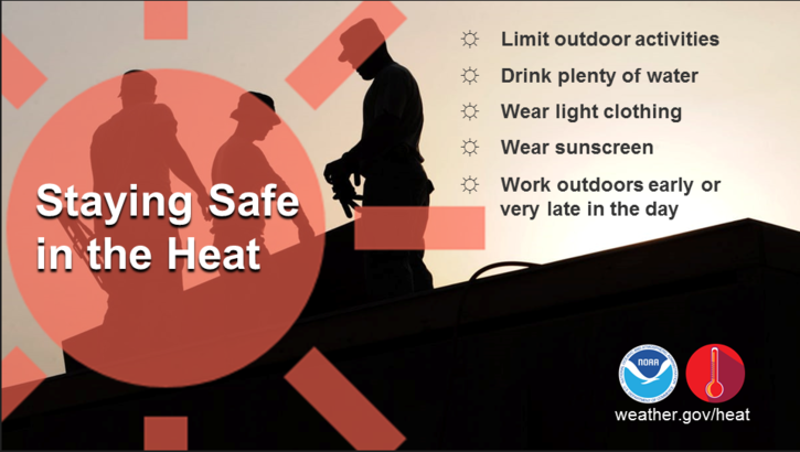
2- Everyone should know what to do to stay hydrated if working outdoors so TAKE THOSE PRECAUTIONS and pay attention to how you are feeling.
3- As stated last night, we are sending our TASK FORCE TEAM 1 to Blaine County to assist in fire operations. They are very experienced so they should be ok. We do remain in constant contact with them so any additional needs will be taken care of.
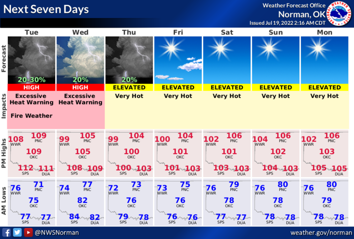
4-Here is your forecast from the NWS/NORMAN;
Today-Sunny, hot with highs around 112. South winds 10 to 15 mph.
Tonight-Mostly clear in the evening, then becoming partly cloudy. A slight chance of showers and thunderstorms. Lows in the upper 70s. Southeast winds 10 to 15 mph. Chance of rain 20 percent. Heat index values up to 111 early in the evening.
HAVE A GOOD DAY!