0420L-WEDNESDAY UPDATE FROM ENID/GARFIELD COUNTY EMERGENCY MANAGEMENT-7/25/18
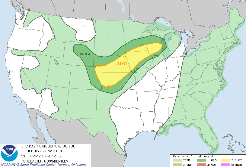
1- HOT TODAY AND POSSIBLY THE BEGINNING OF OVERNIGHT RAINFALL CHANCES INTO NEXT WEEK.
2- If storms occur, heavy rainfall, strong winds, and possibly some hail would be the threats. Make sure you have our GARFIELD COUNTY EM app so you stay up with the latest. Overnight storms would be in the form of an MCS- Meso Convective System. These are similar to what we have had in the recent past overnight. We’ll see what develops.
3- Overall, we’ll be ok but just expect some noise during the overnight hours.
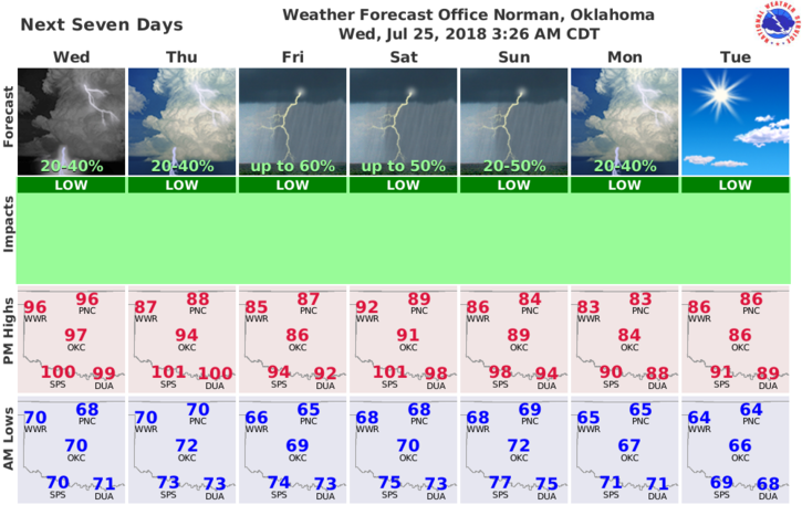
4- Here is your forecast from the NWS/NORMAN;
Today-Sunny. Highs in the upper 90s. South winds up to 10 mph.
Tonight-Partly cloudy. A slight chance of showers and thunderstorms after midnight. Lows around 70. Southeast winds around 10 mph. Chance of precipitation 20 percent.
HAVE A GREAT DAY!!
MIKE