0410L-WEDNESDAY OUTLOOK FROM GARFIELD COUNTY EMERGENCY MANAGEMENT-7/27/22
1- HEAT ADVISORY IN EFFECT FROM NOON UNTIL 8PM TONIGHT… No controlled burning is being asked of everyone due to the fire danger again today. Keep a close eye out for smoke & fire. Call 911 immediately so a quick response can be sent.
2- Here is your forecast from the NWS/NORMAN;
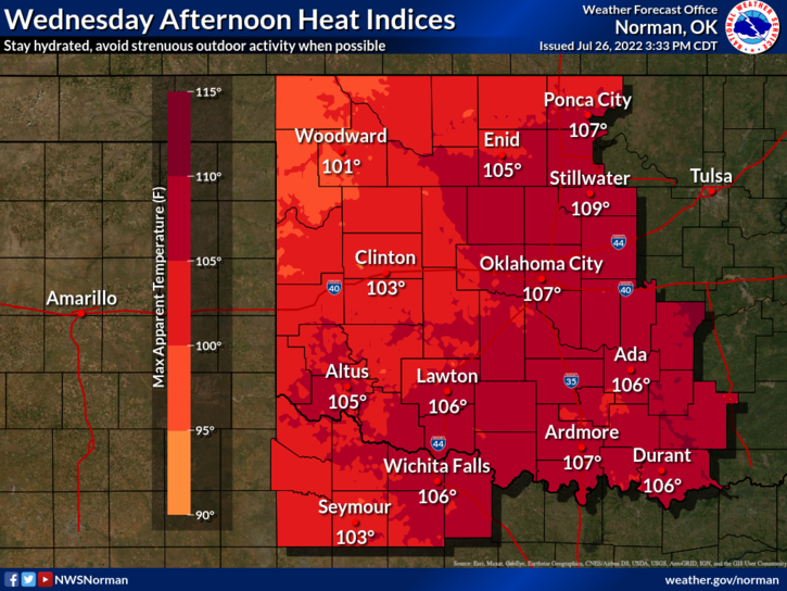
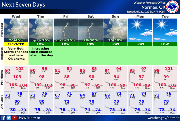
Today-Mostly sunny. A slight chance of showers and thunderstorms this afternoon. Hot with highs around 104. Northeast winds 5 to 10 mph. Chance of rain 20 percent.
Tonight-Mostly cloudy. A slight chance of showers and thunderstorms in the evening, then a chance of showers and thunderstorms after midnight. Lows in the upper 70s. Southeast winds 5 to 10 mph, becoming south after midnight. Chance of rain 30 percent.
3- The cold front everyone is waiting for lingers just to our north basically along the Oklahoma/Kansas line. There is an outflow boundary from convection in Kansas. This may help pull the front farther south and give some relief to fire ops out west. This said, there are a lot of variables here so we can’t get our hopes up too far right now. The front should push in LATER TODAY but for sure on Thursday. Either way, cooler temps and hopefully some rain is on the way.
4- Our Task Force Team 2 has been fighting fire all night and are somewhere along the eastern or northern perimeter of the fire. Phone service is bad in that area. They should be heading home sometime between 6 and 8 am. We will not be sending anyone back out until at least Thursday morning when TEAM 3 will be up for operations. Rest and rehab is needed right now.
5- Donation-wise, I will have the trailer out front again this morning. I will shut down donations at NOON today. THANK YOU ALL that have donated and I plan to have a little better organized system the next time. I don’t have any staffing right now.
Finally, as stated above, cooler weather is coming hopefully with some rain. But remember, the heat will return. I wonder what winter will be like!
STAY COOL AND HAVE A GOOD DAY.