0415L-WEDNESDAY UPDATE FROM ENID/GARFIELD COUNTY EMERGENCY MANAGEMENT-3/14/18
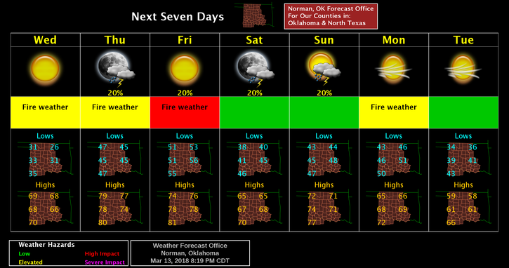
1- TEMPS WILL BE IN THE MID TO UPPER 60’S ALONG WITH 15-25 MPH WINDS. FIRE DANGER IS ELEVATED.
2- I know over the last several months I have harped about the fire danger and many of you are tired of seeing it. Last Monday and Tuesday were the extreme reasons why. We are falling back into similar conditions with higher winds over the next several days. We are extremely dry so adding the winds once again we are asking all citizens here in the county and all around us to keep that special eye out for smoke and fire. Report ANY of either to 911 asap.
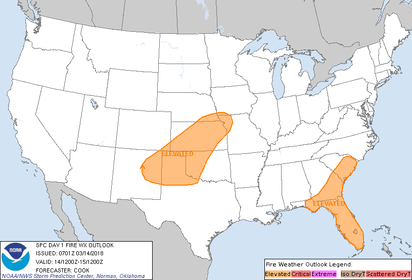
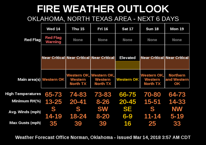
3- I am asking that EVERYONE in the rural areas DO NOT BURN ANYTHING for at least the next 5 days mainly because of the winds. If you burned yesterday, make sure it’s completely out. See the graph, FIRE WEATHER OUTLOOK below on the danger.
4- I would rather be talking rain but it isn’t happening so I will continue to HARP a little more. Hopefully, I don’t chase you away. That said, here is your forecast from the NWS/NORMAN;
Wednesday-Sunny, with a high near 67. South southwest wind 5 to 15 mph increasing to 15 to 20 mph in the afternoon. Winds could gust as high as 25 mph, possibly higher.
Wednesday Night-Mostly clear, with a low around 46. South wind 10 to 15 mph, with gusts as high as 21 mph.
Download our emergency app-GARFIELD COUNTY EM.
HAVE A SUPER DAY AND STAY SAFE
MIKE