FROM GARFIELD COUNTY EMERGENCY MANAGEMENT
3.25 inches of rain at the house since the rain started early evening until 0345L this morning. We had dime and nickel size hail last night with winds gusting around 50 mph. Lightning was interesting except for those that lost power and finally the thunder was cool to listen to.
I have received numerous reports through our app on some damage and electrical outages. If you all would, send me rain totals through the DAMAGE REPORT part of our app along with any pics of damage you have witnessed. It’s greatly appreciated. Our app, if you don’t have it is GARFIELD COUNTY EM.
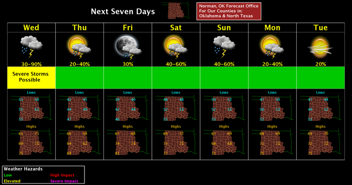
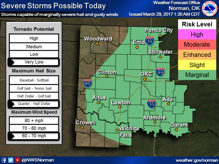
For today, rain will continue for the most for a good part of the day. An embedded thunderstorm is likely at some point. The severe risk is MARGINAL so just expect what we encountered during the overnight hours.
I attended a re-certification class yesterday and I am glad I did. I actually remembered things I forgot but utilized them last night. Good thing for these classes.
Here is your forecast for today;
80% chance for showers and thunderstorms this morning and then a chance this afternoon. New rainfall between 1/10th and ¼ of an inch is possible. Highs near 68 with winds becoming westerly this afternoon 5-10 mph.
Tonight’s low around 44 with a 40% chance for thunderstorms. NNW winds 15-20 gusting to 25mph or so.
Have a super day!!
Mike