FROM GARFIELD COUNTY EMERGENCY MANAGEMENT
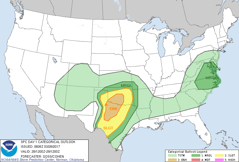
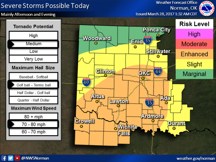
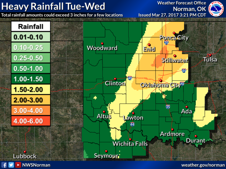
It appears we may have a good chance for some rain. Per the graphics below, we could receive 1-3 inches over the next few days. I just hope that it occurs slowly instead of all at once. We really need the rain. That said; we are in a SLIGHT RISK AREA for severe weather later this afternoon and tonight. Threats for us would be wind and hail. The tornado threat is low. Spotters will be on standby just in case.
A few things have come to light so to speak here lately on getting warnings during bad weather. Here are a few things you need to have;
1- A NOAA WEATHER RADIO PROGRAMMED TO OUR AREA-#4 ON MOST WEATHER RADIOS.
2- OUR GARFIELD COUNTY EM APP-TAKE SOME TIME TO LEARN HOW IT WORKS.
3- TIME TO ACTUALLY READ FORECAST DISCUSSIONS-KNOWLEDGE IS GOOD
4- A COURSE OF ACTION, A PLAN, JUST IN CASE OF SWIRLY THINGS.
5- UNDERSTANDING THAT IF INTERNET IS LOST OR POWER IS LOST, THEN MOST LIKELY NOTHING WILL WORK.
It is very important to have a plan in the event you lose power and the ability to receive information. Those of us who have cable or satellite capability for TV need to understand that we used an antenna to receive TV signals back in the old days. You still can and guess what, it’s free!!! A good HD antenna will cost you around 35-45 dollars. I don’t know who carries antennas locally but you can search for them.
Here is your forecast from the NWS/Norman;
Tuesday-Showers and thunderstorms likely after 1pm. Mostly cloudy, with a high near 69. East wind 8 to 17 mph, with gusts as high as 24 mph. Chance of precipitation is 60%. New rainfall amounts between a quarter and half of an inch possible.
Tuesday Night-Showers and thunderstorms. Low around 55. East wind 11 to 17 mph, with gusts as high as 24 mph. Chance of precipitation is 80%. New rainfall amounts between 2 and 3 inches possible.
Have a super day!!
MIKE