0410L-WEDNESDAY OUTLOOK & INFO FROM GARFIELD COUNTY EMERGENCY MGMT-5/13/2020
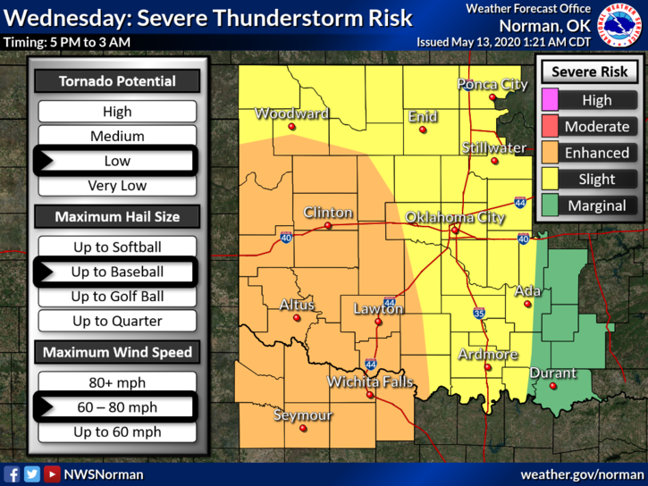
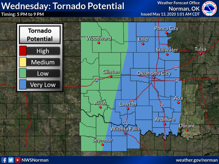
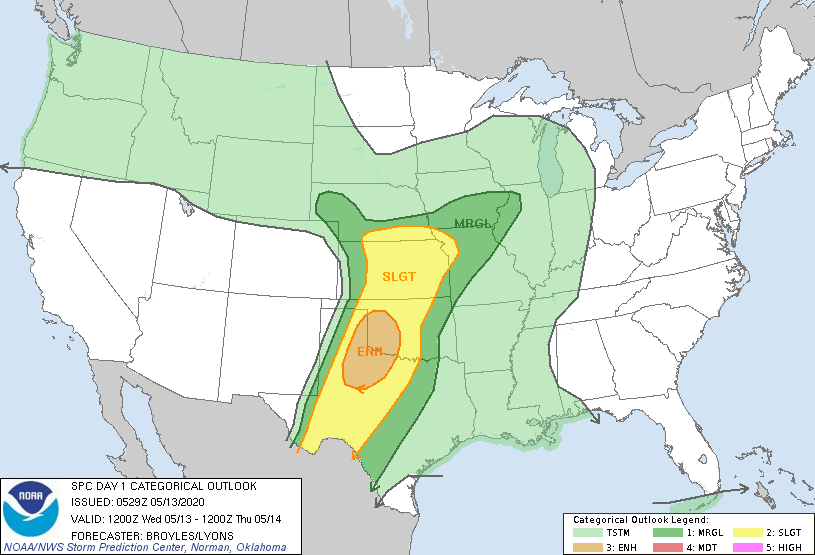
1-We are in a SLIGHT RISK AREA and close to an ENHANCED RISK AREA for severe weather later today. This morning, we can expect a few scattered t-storms. These shouldn’t be severe. Late this afternoon, per guidance, storms should fire in the eastern Texas panhandle and become severe very quickly. The highest tornado risk will be out there along the OK/TX border.
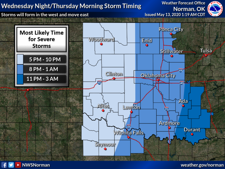
2- As Supercell storms move east, they should grow upscale into a QUASI-LINEAR CONVECTIVE SYSTEM, (QLCS) and move east. This feature should be more prevalent to our southwest. By the time storms reach our area, they should be weakening enough to give us heavy rainfall, intense lightning, and strong winds.
3- Some of this will change during the day so we’ll keep an eye out on the latest info and pass it along over our GARFIELD COUNTY EM app and we’ll do live broadcasts over our emergency management page on Facebook at this address- @EGCEM so take the time to follow that page so you keep up with what’s happening.
4- Here is your forecast from the NWS/NORMAN;
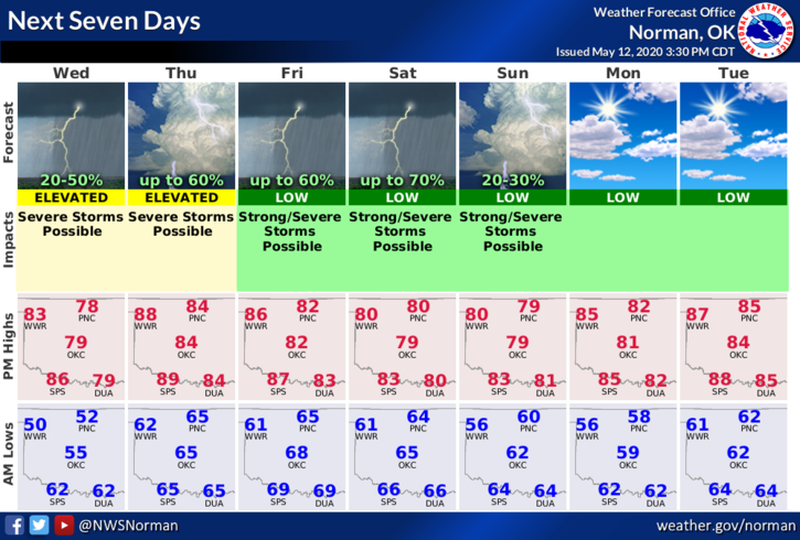
Today-Fog possible early this morning. Cloudy with a chance of rain showers with possible thunderstorms and drizzle this morning. Partly cloudy in the afternoon. Warmer. Highs in the upper 70s. South winds 10 to 20 mph. Chance of precipitation 30 percent.
Tonight-Partly cloudy. A slight chance of thunderstorms in the evening. Warmer. Lows in the lower 60s. South winds 15 to 20 mph. Chance of thunderstorms 20 percent.
HAVE A GREAT DAY!!
MIKE