0405L-TUESDAY OUTLOOK & INFO FROM GARFIELD COUNTY EMERGENCY MGMT-5/12/2020
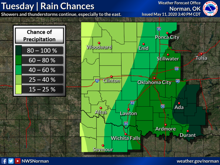
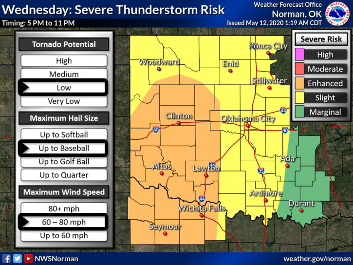
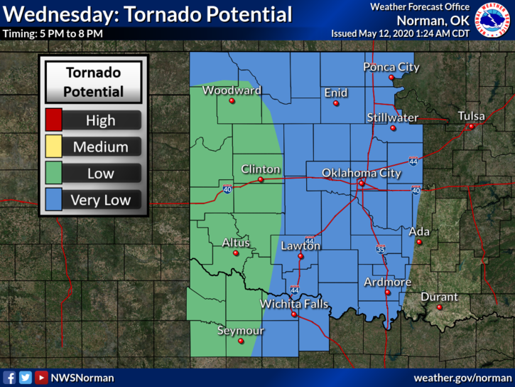
1- We remain in a GENERAL THUNDERSTORM RISK area for today with temps in the 50s. Expect showers off and on again today with maybe a rumble of thunder. Nothing severe is expected. Enjoy these cooler temps as tomorrow, winds will shift and become southerly and we are going to get very humid with temps increasing into the 80s. Severe weather is expected tomorrow late afternoon into the evening hours. I have attached a graphic for this.
2- Don’t freak out on the severe weather issue for tomorrow. Thunderstorms happen. We can’t stop them but we can deal with them. We expect strong winds, torrential rainfall, possibly some hail, and the tornado threat is LOW.
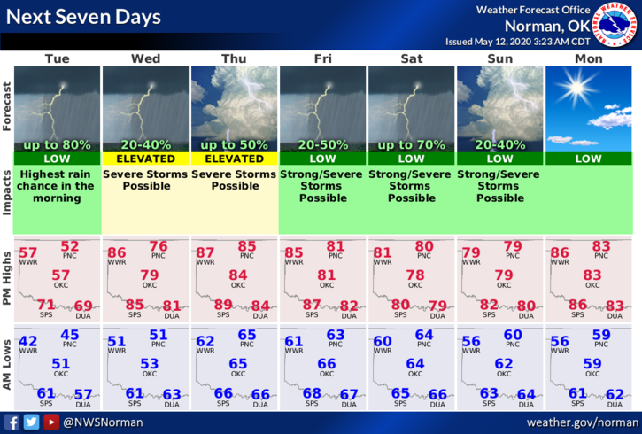
3- This said, here is your countywide forecast from the NWS/NORMAN;
Tuesday- Cloudy with a 50% chance of rain showers and thunderstorms in the morning. Highs in the mid-50s with East winds 10 to 15 mph.
Tuesday Night- Mostly cloudy with a 50% chance of thunderstorms. Lows in the lower 50s with East winds around 10 mph.
DIRECTORS COMMENT-short and sweet;
Download our GARFIELD COUNTY EM app so you can stay up with the latest from us and you’ll receive all advisories and warnings from the NWS as they push those automatically through our app. The app also has a boatload of information so get it, learn it, and utilize it, so you can stay informed. If weather conditions warrant, we will deploy our Storm Spotters as needed.
HAVE A GREAT DAY!!
MIKE