0415L-WEDNESDAY OUTLOOK FROM GARFIELD COUNTY EMERGENCY MGMT-5/27/2020
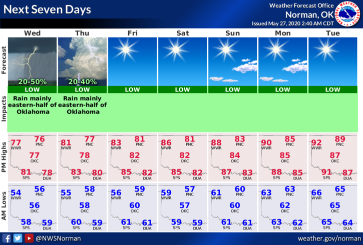
1-GENERAL THUNDERSTORM RISK for today & Thursday. The risk is low due to being on the back side of the upper level cyclone that has caused our weather for the last several days. It continues to move east and per guidance, it should exit the region late Thursday. This weekend looks clear, warm, and I see images of sunburn so be alert to that fact. Overall, improving and good weather should be around from Friday through at least the first half of next week.
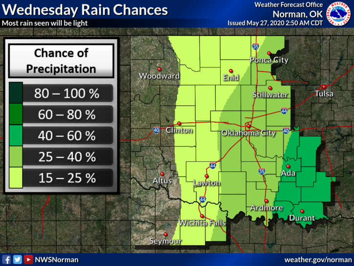
2- Here is your forecast from the NWS/NORMAN;
Today-Partly cloudy with a slight chance of thunderstorms. Highs in the upper 70s. Light and variable winds becoming north around 10 mph in the afternoon. Chance of thunderstorms 20 percent.
Tonight-Partly cloudy. A chance of rain showers and a slight chance of thunderstorms in the evening, then a slight chance of thunderstorms after midnight. Lows in the upper 50s. Light and variable winds. Chance of precipitation 30 percent.
DIRECTOR’S COMMENT
Since we are slowly winding down from the threats of Covid 19, I have asked the Garfield County Health Department to start posting information that is also important to our public. This information will also come over the app and will post to the Emergency Management page. We plan on modifying the Covid 19 icon on the app to say Public Health and Covid 19 or something to that effect.
I feel it’s important to continue to give the public important information that pertains to everyday life so your questions can be answered by health officials and they can help give you guidance when health issues come up. When the modification occurs, I will advise you on this. This is just another way we get important health info to you and yours.
HAVE A GREAT DAY!!
MIKE