0340L-WEDNESDAY OUTLOOK & INFO FROM GARFIELD COUNTY EMERGENCY MGMT-11/27/19
1- GARFIELD COUNTY EM-This is our emergency and notification app. Several folks yesterday were complaining about the NOAA alerts. Those come directly from the NWS. You can turn them off; I wouldn’t advise that, by going to settings, notification settings, scroll down to NOAA alerts and tap the button. These will be the same folks complaining that they aren’t receiving those alerts in the future. Welcome to my world!! J
2- We were lucky that we only had a few fires in the county yesterday. Several departments were moving very quickly to get a handle on them especially north of Garber. No homes lost and no one got hurt. This is a reminder that even without 50mph+ wind gusts, foliage is dry. If a fire gets started, especially as dry as we are, bad things can happen quickly. Just remember to report ANY SMOKE OR FIRE TO 911. They will get a response headed that way.
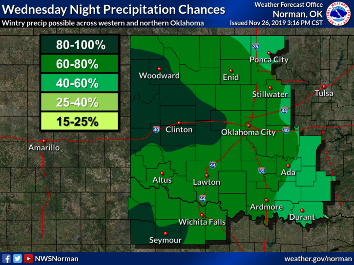
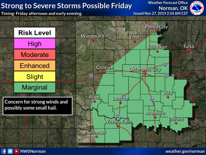
3- Weather-wise, snow for us tonight looks bleak and the severe threat for Friday went down from a Slight risk to a Marginal risk. If you plan on traveling this weekend, depending where you go, check the forecast at both your destination and of course at home.
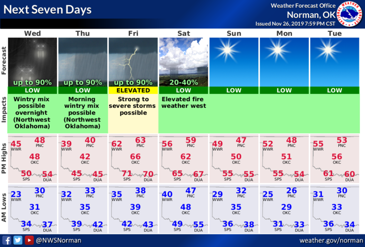
4- Here is your forecast from the NWS/NORMAN;
Wednesday-Sunny and cooler. Highs in the upper 40s. Northwest winds, 10 to 15 mph gusting to 20, shifting to the north in the afternoon.
Wednesday Night- Mostly cloudy with a 70% chance for rain after midnight. Lows in the lower 30s. Light and variable winds.
HAVE A GOOD DAY!!
MIKE